
A stone monument carved with a decapitation scene sat in a jungle clearing in southern Mexico for more than a thousand years, untouched. No looter’s trench disturbed the earth around it. No machete trail connected it to the outside world. The date inscribed in its limestone face reads 849 CE – a specific moment frozen in ancient Maya script, left as if waiting for someone to arrive and read it.
Someone finally did, in 2026.
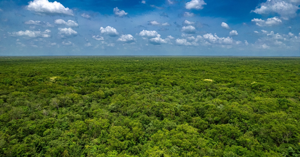
The discovery of a lost Maya city named Minanbé is one of those rare archaeological moments where a place fully earns its name. The site is called Minanbé, the Yucatec Maya word for “there is no path.” On June 22, 2026, Mexico’s National Institute of Anthropology and History (INAH) announced the discovery of Minanbé – an intact, unlooted Maya city deep in the jungles of the Calakmul Biosphere Reserve, Campeche, at the base of the Yucatán Peninsula. The name wasn’t chosen romantically. It was the physical reality the research team faced when they tried to reach it.
The city was identified by an international team led by archaeologist Ivan Šprajc of the Research Center of the Slovenian Academy of Sciences and Arts, with authorization from INAH. The discovery follows three decades of research, during which Šprajc identified more than 80 Maya sites across the largely unexplored Central Maya Lowlands of the Yucatán Peninsula. Šprajc himself has admitted more than once that a particular field season would be his last, given how brutal the work is. “But it is such a reward when you find a new site,” he told The Guardian in 2014.
How LiDAR Revealed a Lost Maya City Buried Under the Canopy
Like other sites in the region, Minanbé was identified through LiDAR (Light Detection and Ranging) surveys. “LiDAR is a powerful scanning method,” Šprajc says. “It allows us to see through vegetation, identifying features that stand out from the natural terrain.” The technology fires laser pulses from aircraft toward the ground, measuring the time each pulse takes to bounce back. When those returns are mapped, structures buried under forest canopy emerge as subtle but unmistakable geometric patterns.
LiDAR has enabled researchers to identify hundreds of thousands of structures in Mayan cities across southern Mexico, and its track record in this region is formidable. A 2025 piece in Reason noted that the technology has helped uncover “a vast, interconnected network of cities, roads, and infrastructure” across the Maya world – overturning older assumptions that the Classic Maya lived in small, scattered settlements rather than dense urban networks.
For Minanbé specifically, the transition from LiDAR images – which revealed a 15-hectare settlement beneath the forest layer – to ground verification confirmed the existence of a complex urban core. But seeing the city from the air and reaching it on foot were very different problems. The area hiding Minanbé was the final candidate up for exploration. The team had to clear roughly 3 miles of thick jungle growth, then walk up another 3.7 miles to reach the site itself.
Illegal logging has opened paths through parts of the reserve, but none exist here, hence the city’s name. For Šprajc, that absence of old logging roads was actually an encouraging sign. Sites accessible by those roads tend to be looted. He noted that “in the last three years, this is the first one we’ve found intact, with no signs of looting.”
What the Team Found Inside
Minanbé contains plazas, terraces, water channels, palaces, religious structures, and a pyramid temple rising more than 40 feet high. The water management infrastructure is particularly telling – it indicates the city wasn’t a minor ceremonial outpost but a functioning urban settlement capable of supporting a substantial population through carefully engineered hydrology.
The most visually striking structure is the pyramid. The pyramidal temple rises nearly 43 feet (13 meters), built in the Río Bec style of the Classic Maya era between 600 and 900 CE. The Río Bec style, centered in what is now Campeche state, is characterized by precisely cut limestone masonry, elaborate decorative facades, and towers that mimic larger pyramids. According to archaeologist Vitan Vujanović, the structure includes finely crafted masonry, decorative façade panels, steep staircases, and upper moldings. “This is the first time I have recorded a temple that is relatively well-preserved and still associated with a stela bearing glyphs,” Vujanović said.
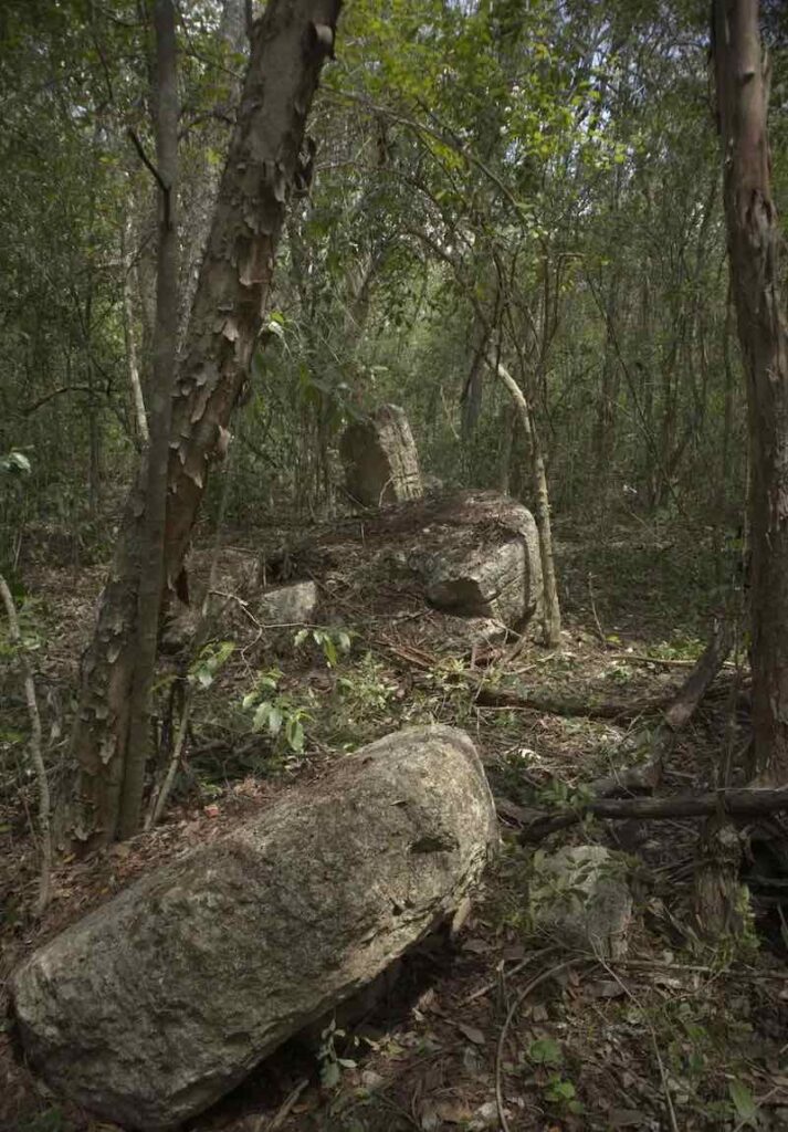
Archaeologists documented 14 stone monuments, including stelae and altars, along a causeway linking the city’s center and northeast. Stelae are free-standing carved limestone slabs used by Maya rulers to record political events, calendar dates, and ritual scenes. The fact that 14 survive at Minanbé, largely intact, is extraordinary. At most comparable sites across the region, these monuments have been stripped, smashed, or carted off entirely.
Using hundreds of photographs, the team created three-dimensional models of each of the 14 altars and stelae, which were sent to Octavio Esparza Olguín, an epigrapher at the National Autonomous University of Mexico (UNAM), for study. Esparza Olguín used advanced editing software to discern the hieroglyphic texts, a complex task due to erosion affecting most of the limestone surfaces.
The Stone That Dates a City’s Final Years
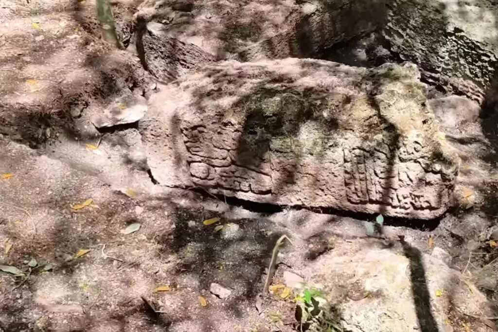
One of the stelae depicts a figure decapitating another with an axe or knife and bears the date 5 Ajaw, corresponding to 849 CE. That date places the monument in the Terminal Classic period, a stretch of time when Maya civilization across the southern lowlands was beginning a profound transformation. Stela 1, as the monument is designated, gives archaeologists a fixed point to anchor the site’s entire occupation timeline – a rare anchor in a region where most carved stone has been removed or destroyed.
Esparza Olguín said the find “suggests that at least some of the monuments were erected shortly before Maya sites were abandoned in the 10th century CE,” noting that decipherment is ongoing. The decapitation scene itself isn’t unusual in Maya iconography – it appears in political contexts, often commemorating military victories and the ritual sacrifice of captives.
The discoveries at Minanbé are located within an agricultural area that reached its peak during the Late Classic period (600 to 900 CE), a time of intensive agricultural production and the trade of surplus foods. That peak – and the apparent abruptness of its end – is exactly what makes the site so valuable to researchers studying what happened to the Maya during the centuries following 800 CE.
The Maya collapse remains one of archaeology’s most contested questions. A 2025 study led by researchers at the University of Cambridge, analyzing chemical signatures in a Yucatán cave stalagmite, found that the Terminal Classic period coincided with eight wet-season droughts, the longest of which lasted 13 consecutive years. Earlier research found that the ancient Maya adapted to previous episodes of climate drying but could not cope with the more extreme droughts of the Terminal Classic. Minanbé, abandoned around the 10th century, fits precisely within that timeline.
As researchers investigate Minanbé in the future, they will explore possible incursions by groups from the northern Yucatán Peninsula who disrupted the abandoned city’s power structure. That’s a reference to a theory that northern Maya polities – particularly those centered around Chichén Itzá – may have moved into the political vacuum left by collapsing southern cities, accelerating the region’s depopulation rather than simply inheriting it.
The Archaeologist Behind the Discovery
Since 1996, Šprajc has led numerous INAH-approved research projects, including more than ten field seasons of archaeological reconnaissance in protected natural areas during the dry season, from March to June. His team works a narrow window each year – the dry months when the jungle is slightly less hostile – before retreating as the rains return.
Among his previous discoveries are the nearby Maya sites of Chactún (in 2013) and Ocomtún (2023). Chactún, found roughly a day’s hike from Minanbé, was the first major Maya city Šprajc’s team documented in that stretch of the Calakmul Reserve. Ocomtún, found a decade later, revealed a large regional center on elevated ground with multiple pyramid-like structures and ball courts. Each find extended the known map of Classic Maya settlement in a region where the archaeological record had been almost entirely blank.
The 723,185-hectare Calakmul Reserve is Latin America’s second-largest remnant forest after the Amazon. The reserve and the ancient Maya city of Calakmul are jointly inscribed on the UNESCO World Heritage list. That protective designation – combined with the sheer difficulty of accessing much of the reserve’s interior – is likely the reason so many sites here survived the 20th century without being plundered.
The broader importance of Šprajc’s work extends beyond individual sites. During the Late Classic period, the discovery of Minanbé provides new evidence of the vast agricultural and political network that characterized the Maya Lowlands, when millions of people inhabited the region. Each new city found within the reserve adds to that picture, helping researchers map not just where the Maya lived but how their cities related to one another economically and politically.
Read More: Student Makes Miraculous Discovery of Ancient Mayan City ‘By Accident’
What Minanbé Can Still Tell Us
According to Šprajc, Minanbé sat undisturbed for more than a thousand years. It is the first unlooted city this team found in three years of searching. That status is genuinely rare. Across the Yucatán Peninsula and Guatemala’s Petén region, the vast majority of documented Maya sites show at least some evidence of looting – tunnels dug into pyramid cores, altars smashed to extract portable carvings, burial chambers emptied for the jade and obsidian they once held. At Minanbé, none of that happened.
Photogrammetric surveys were conducted on the monuments using hundreds of photographs to create detailed three-dimensional models. Those models allow epigraphers to study the glyphs remotely and share high-resolution data with specialists around the world, extending the analytical reach of a small field team working in difficult conditions. Decipherment of the hieroglyphic inscriptions is still in early stages, and what remains carved into those 14 monuments may yet yield names, dates, and political narratives that reshape the known history of this part of the Maya world.
“Each new site helps us better understand the complexity of Maya civilization,” Šprajc said. He has also noted that “Minanbé has the potential to expand our understanding of its development, its relationships with surrounding regions, and the political geography of this part of the Maya Lowlands.”
What This Means for Our Understanding of the Maya
Minanbé adds a concrete data point to an ongoing effort to reconstruct one of the ancient world’s most sophisticated civilizations. LiDAR aerial surveys combined with boots-on-the-ground fieldwork have changed the pace of Maya archaeology in ways that would have been unimaginable two decades ago. Sites that would have taken years to locate by traditional survey methods are now identified in a single flight, leaving field teams to focus their energy on reaching them and recording what they find.
Šprajc’s team has spent 30 years exploring a fraction of the Calakmul Reserve, finding more than 80 sites and still encountering intact cities. Minanbé’s 14 carved monuments, its unplundered plazas, and the 849 CE date inscribed on a stone face in the jungle are a reminder that the historical record of the ancient Maya is far from complete. Every dry season that a team cuts its way through the undergrowth, the record gets a little fuller.
AI Disclaimer: This article was created with the assistance of AI tools and reviewed by a human editor.