

Despite major advances in satellite imagery, GPS technology, and digital mapping tools, large portions of our planet remain only partially understood. While cities and highways are visible in sharp detail, many remote and rugged areas lack high-resolution mapping due to their inaccessibility. Dense rainforests, harsh polar regions, and deep ocean trenches all present serious challenges for researchers and cartographers. In some cases, geopolitical conflicts or legal protections limit outside access. In others, extreme weather and natural barriers make exploration nearly impossible. Below are 11 unexplored places that, according to scientific research and verified reports, have yet to be fully mapped.
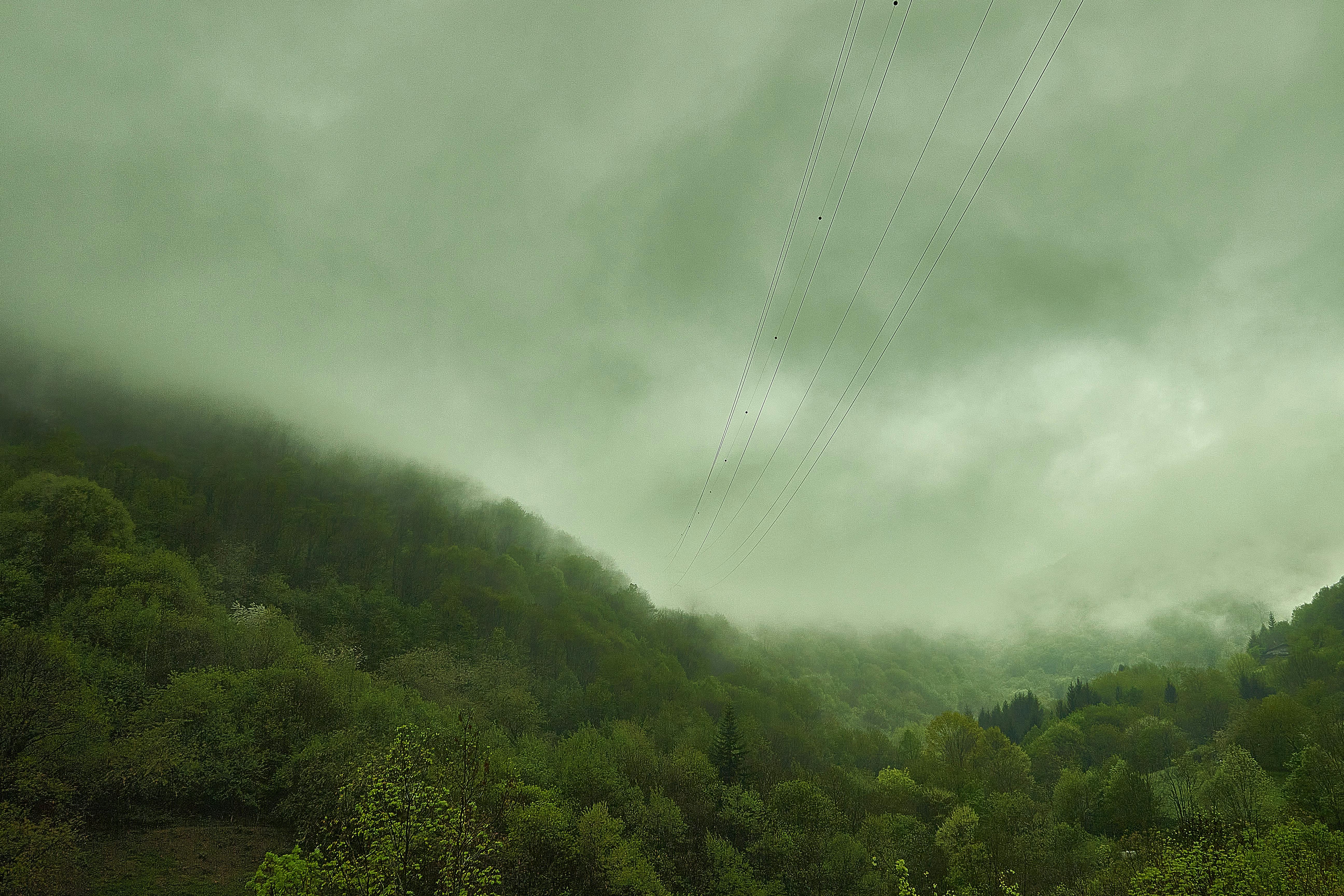
Vale do Javari, Amazon Rainforest, Brazil
This remote region in the western Brazilian Amazon remains largely unmapped on the ground, primarily due to the presence of uncontacted indigenous tribes who inhabit the area in isolation. To safeguard the health, culture, and autonomy of these communities, the Brazilian government strictly limits outsider access, including researchers, developers, and tourists. These restrictions also serve to preserve the ecological integrity of the surrounding rainforest, which is among the most biodiverse ecosystems on the planet. While satellite imagery can provide a general overview of the dense forest canopy from above, it cannot penetrate the tree cover to capture accurate details of the terrain, river systems, or human settlements beneath. As a result, comprehensive mapping of the region’s physical and human geography remains unavailable and incomplete.
North Sentinel Island, Bay of Bengal
Home to the isolated Sentinelese tribe, this island in the Bay of Bengal is effectively off-limits to outsiders. The Sentinelese have consistently and aggressively rejected all attempts at contact, often responding with violence to approaching boats or aircraft. This extreme isolation is believed to have lasted for thousands of years, making the tribe one of the most untouched and least understood human populations on Earth. To protect both the tribe’s way of life and their vulnerability to outside diseases, the Indian government has imposed strict bans on visiting or conducting any form of research on or near the island. As a result, no scientific surveys or detailed topographic mappings exist, and the island’s interior remains a complete mystery in terms of ecology, geography, and human activity.
Gangkhar Puensum, Bhutan
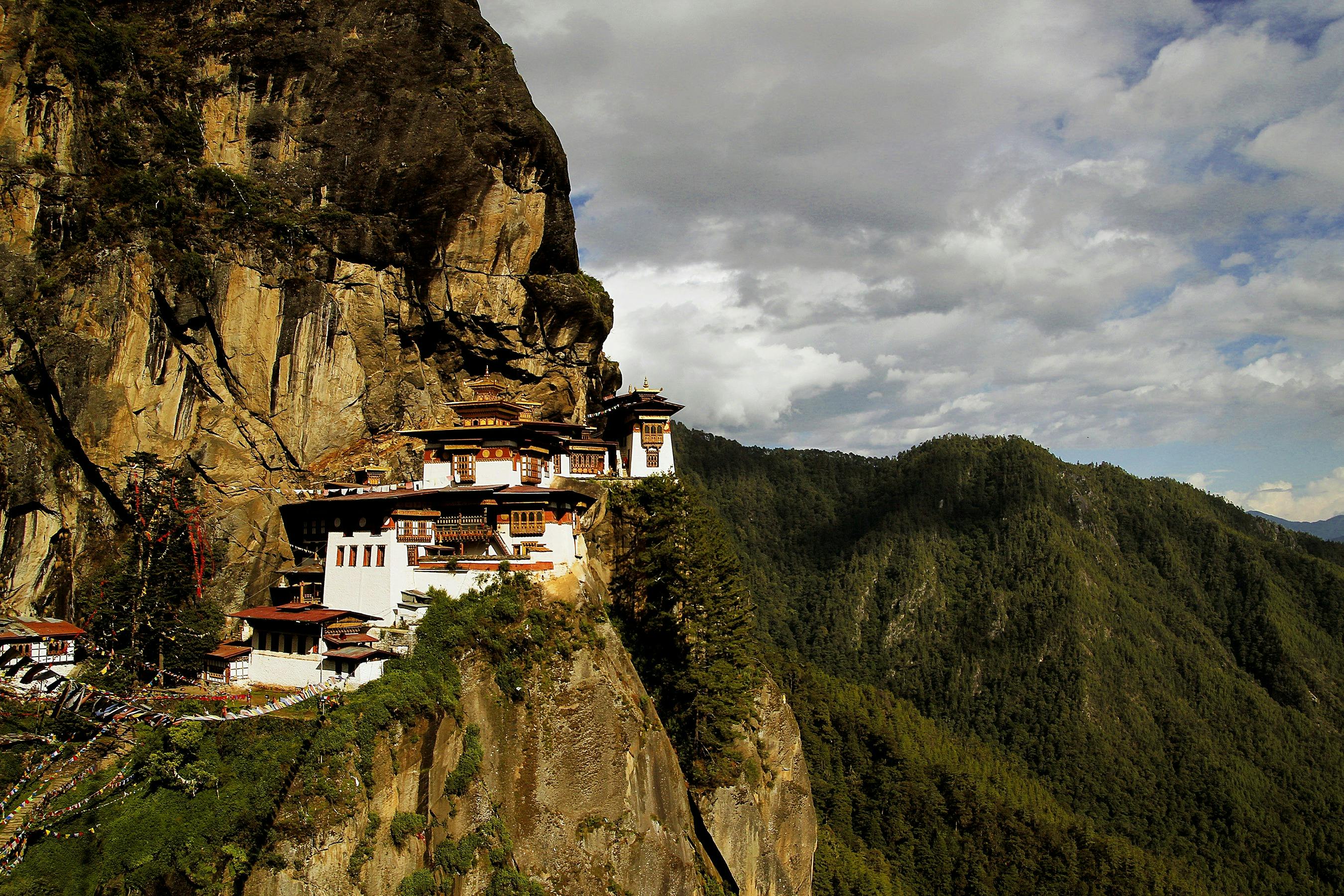
At 24,836 feet, this mountain holds the distinction of being the highest unclimbed peak in the world. Located in the remote regions of Bhutan near the border with Tibet, it has remained untouched by mountaineers due to a national policy that prohibits climbing peaks higher than approximately 19,500 feet. As a result of this ban, no formal expeditions have reached the summit or even attempted a serious ascent, and the upper elevations along with much of the surrounding terrain remain unexplored and unmapped by ground teams. With no recorded human footprints on its slopes, the mountain’s topography, geology, and potential glacial features continue to be a mystery.
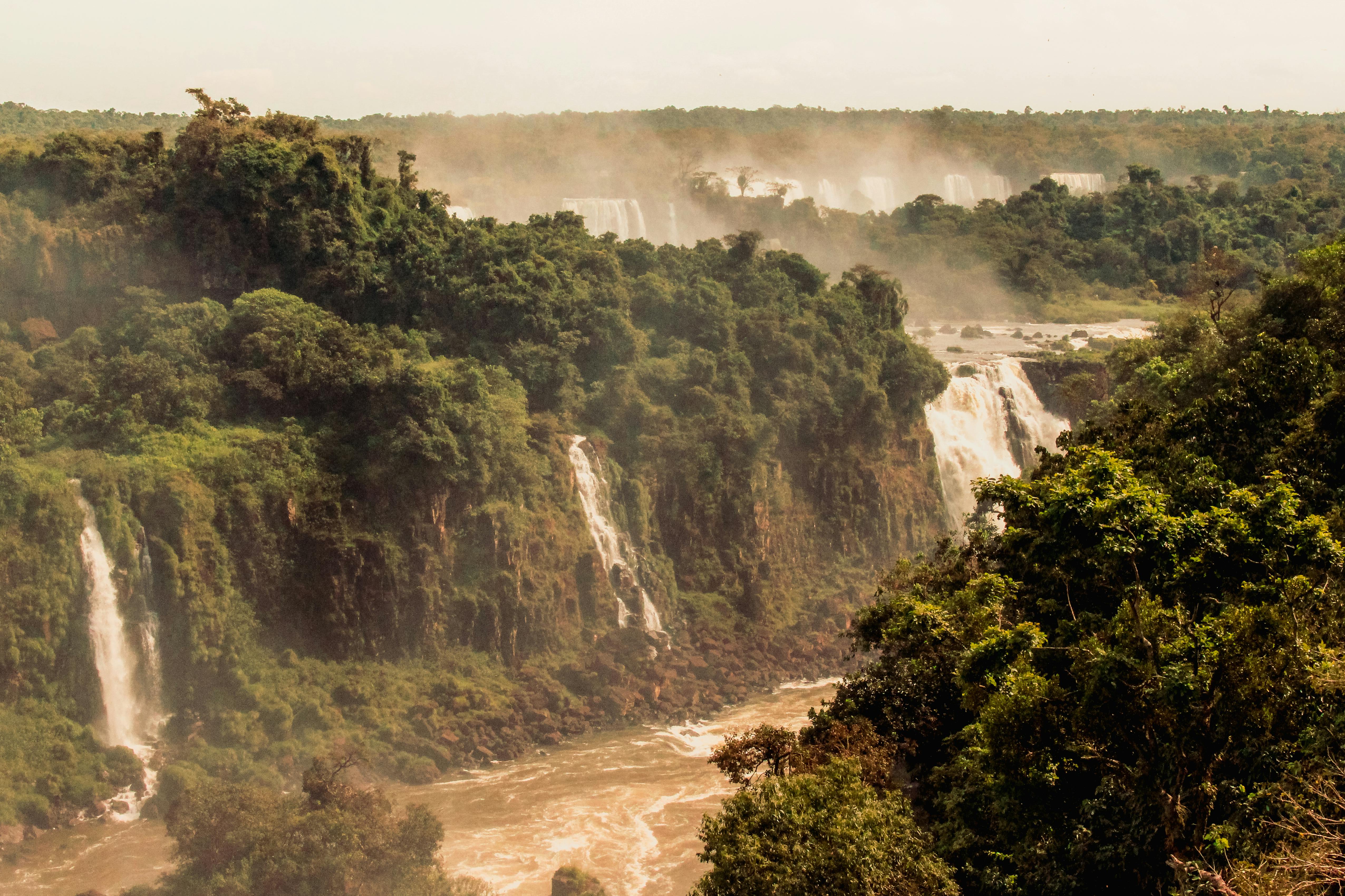
Mariana Trench, Western Pacific Ocean

The deepest oceanic trench on Earth is largely unexplored. Most voyages are targeted at the Challenger Deep, the deepest known point, which is nearly 11,000 meters below sea level. The extreme depth, crushing pressure, and complete darkness of the trench make exploration a highly complex and expensive undertaking. As a result, vast areas of the trench remain unmapped in high resolution, with only coarse sonar data available for most parts. The technological limitations of deep-sea submersibles, combined with the enormous costs of deploying them for long-duration missions, have hindered large-scale mapping efforts. This leaves much of the trench’s structure, geology, and potential ecosystems still largely unknown to science.
Star Mountains, Papua New Guinea
This rugged, jungle-covered mountain range is located in one of the most remote and inaccessible regions of the world, making it exceptionally challenging to explore on foot. The combination of steep terrain, dense vegetation, and limited infrastructure has discouraged large-scale expeditions and scientific studies. Although satellite imagery provides a basic overview of the landscape, it lacks the resolution needed to capture fine details such as microhabitats, species distribution, and topographic variation within the forest. As a result, detailed terrain surveys and comprehensive ecological mapping are extremely limited. The region remains largely scientifically unexplored, with many of its plant and animal species, geological formations, and climatic patterns still undocumented and poorly understood.
Northern Greenland Ice Sheet

Harsh polar conditions, including extreme cold, strong winds, and long darkness, make ground exploration beneath Greenland’s northern ice sheet very difficult. Constant glacier movement adds to the challenge, distorting or hiding features below the surface. These shifting ice flows make it hard to gather accurate data with traditional surveys. As a result, the under-ice topography and geology remain mostly undocumented. Researchers have collected only limited data using satellite radar and ice-penetrating tools. Much of the terrain, ancient rock layers, and possible meltwater channels remain unknown, leaving major gaps in our understanding of this part of the polar region.
Mount Lico, Mozambique
Mount Lico, an isolated volcanic inselberg that rises steeply from the surrounding landscape, challenges access with its near-vertical cliffs. Researchers first reached its forested summit plateau in 2018, using climbing equipment to scale the cliffs. This expedition marked the first documented human entry into the summit ecosystem. Before then, scientists had only roughly identified Mount Lico through satellite imagery and knew very little about what lay above the cliffs. The area still lacks thorough study, especially regarding its biodiversity, soil composition, and ecological relationships. Early research has revealed the presence of unique and potentially endemic species. Although much of the mountain’s ecosystem remains undocumented and awaits detailed scientific investigation.
Vast Seamounts of the Deep Ocean

These geological features, which rise from the seafloor but do not reach the surface, often host rich and diverse marine ecosystems. However, the vast majority remain poorly understood in terms of their physical structure, biological communities, and ecological significance. The primary reason is the lack of high-resolution bathymetric data, which is essential for accurate mapping. These undersea environments are often located in remote and deep parts of the ocean, so the cost and technical demands of detailed exploration have limited scientific access, leaving a major gap in our understanding of the deep-sea landscape.
Underwater Cave Systems and Cenotes
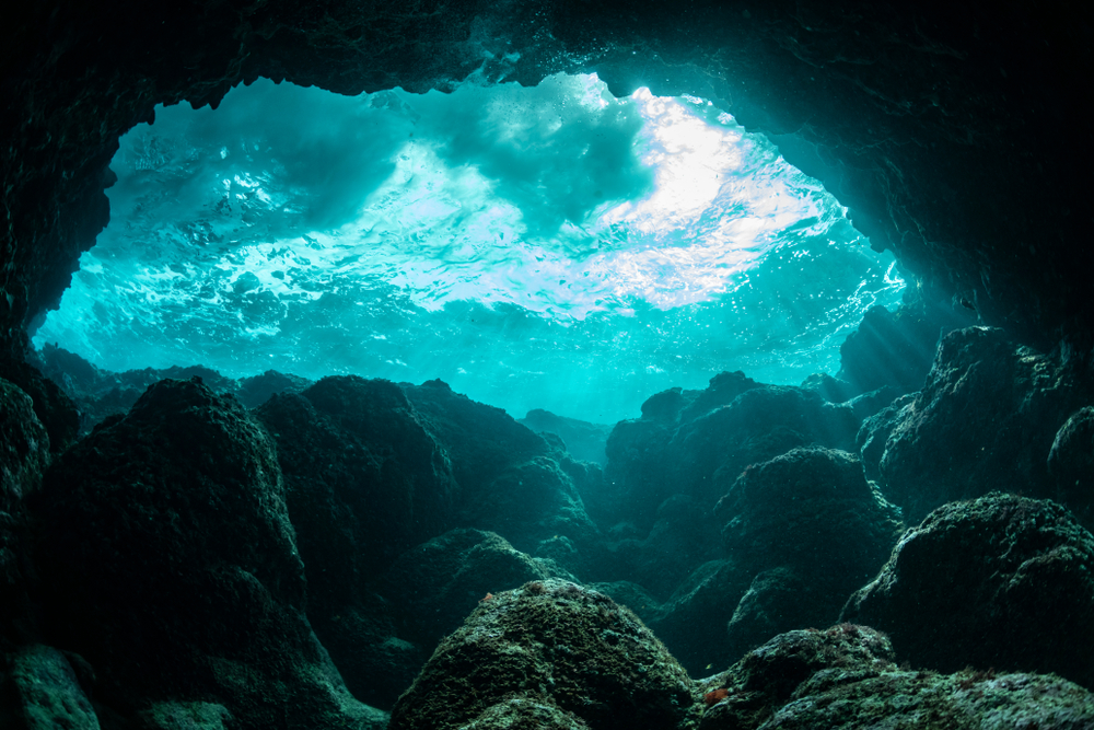
Underwater caves, such as Mexico’s cenotes and global karst systems, are among the hardest natural features to map. These complex, mile-long networks pose challenges like darkness, strong currents, low visibility, and unstable formations. Divers use guide lines and hand-held sonar to navigate, but the resulting data is often limited and incomplete. As a result, most of these systems remain largely unexplored, with vast sections still completely unmapped.
Enigmatic Desert Plateaux and Lost Worlds

Remote plateaux like Guyana’s tepuis and Chad’s Enedi Massif rank among the least surveyed places on Earth. Reaching them often takes days of travel through dense jungle, desert, or rugged terrain. Once there, steep cliffs, harsh weather, and limited infrastructure pose additional obstacles to exploration. Political instability in surrounding regions, especially in parts of Central Africa, further complicates scientific access and long-term research efforts. These plateaux often contain unique geological formations shaped by millions of years of erosion. Exhibiting fascinating rock structures, sinkholes, and hidden valleys. Their complex geology remains poorly documented due to the difficulty of mounting sustained mapping projects in such unforgiving environments. As a result, many aspects of their structure, composition, and potential ecological significance are still largely unknown.
Nahanni National Park, Northwest Canada

Nahanni National Park lies in a remote region where rugged terrain severely limits access. Legends about unexplained disappearances and mysterious events have fueled its mystique and discouraged explorers from venturing deep into the area. Researchers and explorers have mapped only the river corridors, using them as the primary routes through the dense wilderness. They have left much of the surrounding landscape, including deep valleys, vast forests, and mountainous regions, largely unmapped on foot. As such, they have conducted few detailed surveys or ecological studies, leaving large portions of the park’s interior largely unexplored. This lack of access and data has helped preserve Nahanni’s reputation as one of North America’s last untouched wilderness frontiers.
Conclusion

Despite modern technology, Earth remains partially unmapped, from remote tribes and high mountains to deep ocean trenches and underwater caves. These last frontiers offer valuable opportunities for science, conservation, cultural understanding, and exploration. Progress in technology and cooperative frameworks continues to expand our knowledge of these unknown landscapes.
Read More: The U.S Recently Issued a Rare Global Travel Warning. Here’s What You Should Know
Disclaimer: This article was created with AI assistance and edited by a human for accuracy and clarity.