
Scientists have identified the USA’s three most lethal tsunami risk zones, and millions of people live directly in the path of destruction. The Pacific Northwest, East Coast, and Gulf Coast face different levels of catastrophic dangers from these towering ocean waves. These aren’t distant threats and are ticking time bombs triggered by earthquakes, underwater landslides, and rising seas.
What Turns Normal Ocean Into a Killer Wave
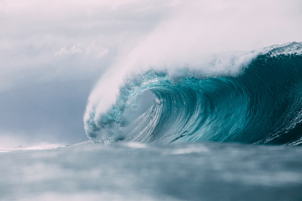
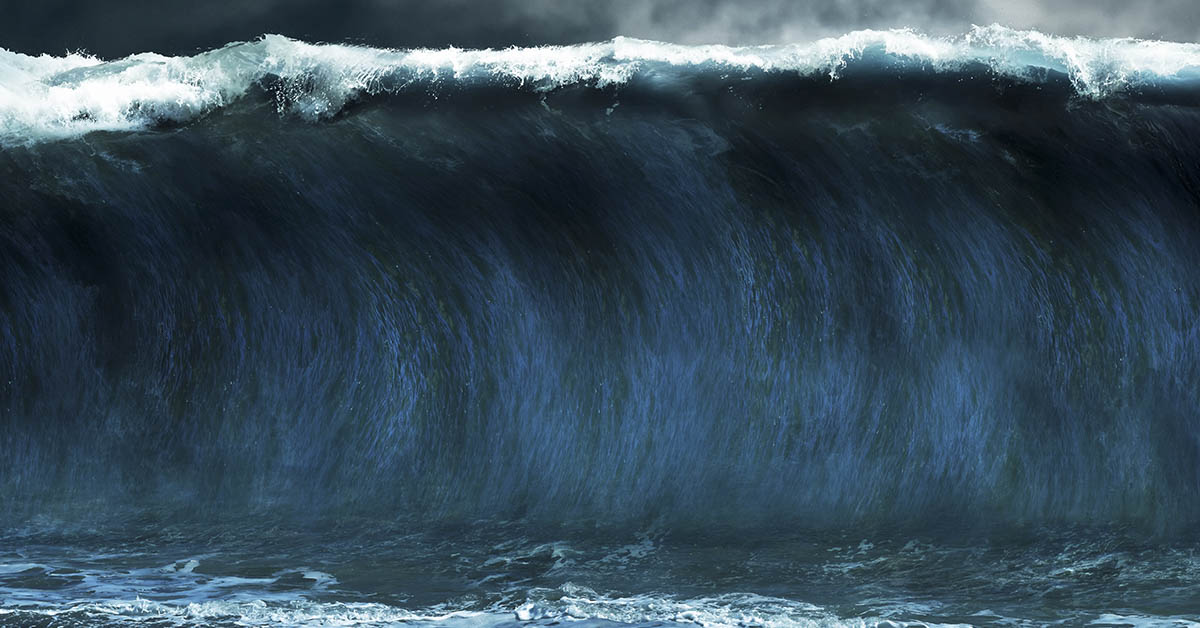
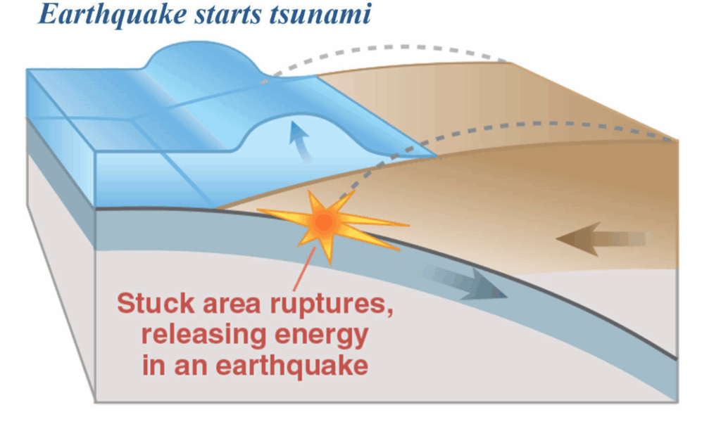
Tsunamis are nothing like regular beach waves. These massive killer waves start when something enormous moves underwater: earthquakes, landslides, or volcanoes. They race across oceans at speeds up to 500 miles per hour, moving water from the ocean floor to the surface. Out in the deep ocean, These massive waves look deceptively calm, but when they hit shallow water near coastlines, they grow taller and more destructive. Their speed depends on water depth, not distance traveled. Tsunamis are NOT tidal waves.
Pacific Northwest – USA’s Highest Tsunami Danger Risk Zone
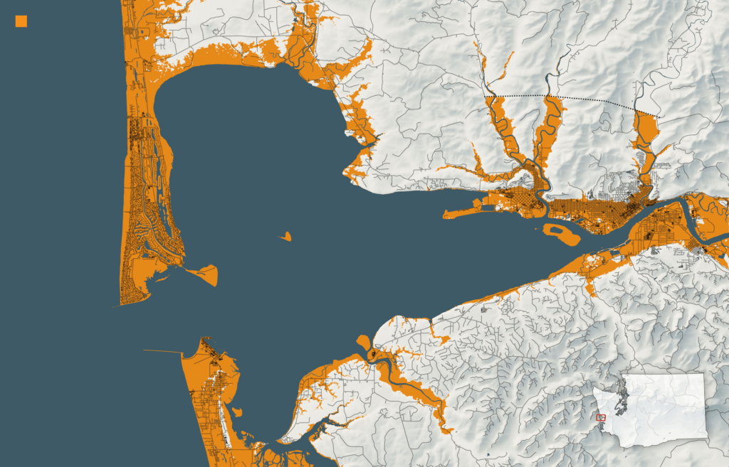
Washington, Oregon, and Northern California sit directly above a 700-mile underwater fault line called the Cascadia Subduction Zone. The last time this geological giant released its power was January 26, 1700, creating waves so overwhelming big they crossed the entire Pacific Ocean and hit coastal Japan. Scientists believe there’s a 10 – 14% chance of another magnitude 9.0+ earthquake happening within the next 50 years. These waves could reach between 30 to 100 feet high, obliterating everything in their path. When these powerful earthquakes cause coastal land to suddenly drop several feet, the disastrous flooding becomes much worse of a problem, leaving communities trapped below sea level.
Ghost Forests Tell a Terrifying 300-Year-Old Story
Walk the Pacific Northwest coast and you’ll see “ghost forests” where dead trees stand bleached white against gray winter skies. These eerie markers show where the land dropped suddenly in 1700 during the last mega-wave event. The Native American stories tell of giant waves that swallowed entire villages. Japanese records confirm the 1700 wave crossed the Pacific. Scientists have found evidence that these massive waves strike every 300 to 600 years. We’re overdue.
East Coast – The Sleeping Giant Most People Ignore
The East Coast faces equal danger from underwater landslides and distant earthquakes. However, the main threat lurks on the continental shelf, where earthquakes around magnitude 4.5 could trigger underwater landslides. The 1755 Lisbon earthquake proved how far tsunamis can travel, sending lethal waves across the Atlantic to North America. Caribbean earthquakes pose a major threat to Florida and the Southeast. The Caribbean fault system runs 2,000 miles and could affect over 35 million people.
When the Caribbean Turned Lethal
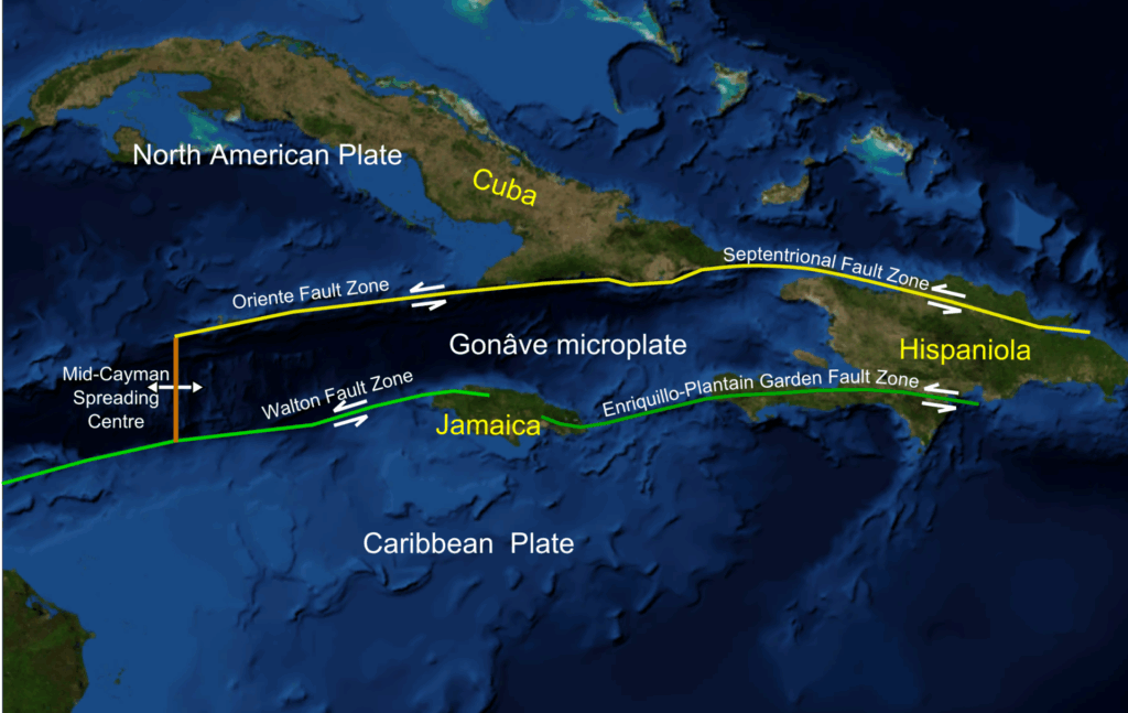
Puerto Rico learned this harsh lesson in 1918 when a massive wave killed 40 people. The Dominican Republic tsunami in 1946 was even more devastating, killing over 1,600 people. The Caribbean has a history that most Americans ignore. These aren’t ancient history campfire stories but urgent warnings of what could happen again. The fault systems remain active, steadily building pressure, waiting to release the next mega-killer wave.
Gulf Coast – Don’t Get Too Comfortable
The Gulf Coast has the lowest tsunami risk in the USA, but “lowest” doesn’t mean “zero.” This region gets some protection from Florida, Cuba, and shallow continental shelves that act as natural barriers. Historical huge waves here have reached less than 3 feet tall, resembling aggressive storm surges rather than true tsunamis. Most here are seiches, which are water oscillations caused by storms rather than earthquakes. The main risks still come from Caribbean earthquake sources, so complacency kills.
Climate Change Is Making Everything Worse
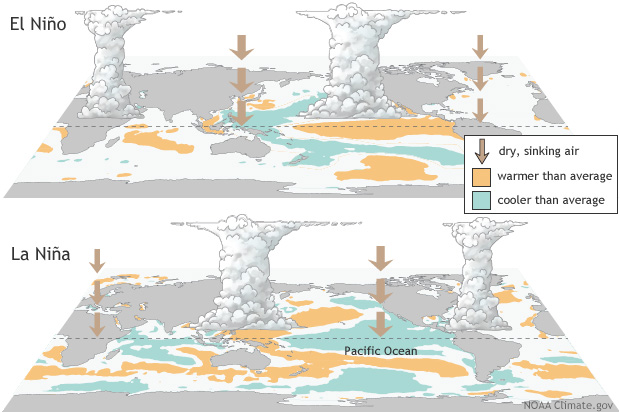
Rising seas are amplifying risks everywhere, especially in the Pacific Northwest. Higher water levels allow these waves to reach farther inland, while protective beaches steadily wash away. Combine rising seas with Pacific Northwest land sinking and you get compound flooding worse than either disaster alone. Recent studies show that 3 to 7 inches of sea level rise caused 70% more beach erosion during El Niño, a preview of our climate-changed future.
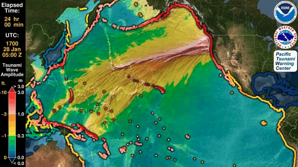
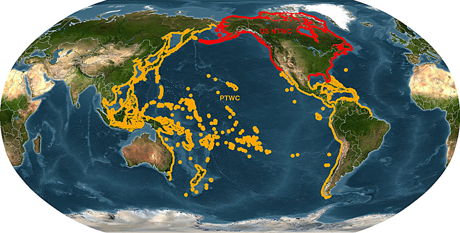
Tsunami Risk Warning Systems in the USA Have One Fatal Flaw
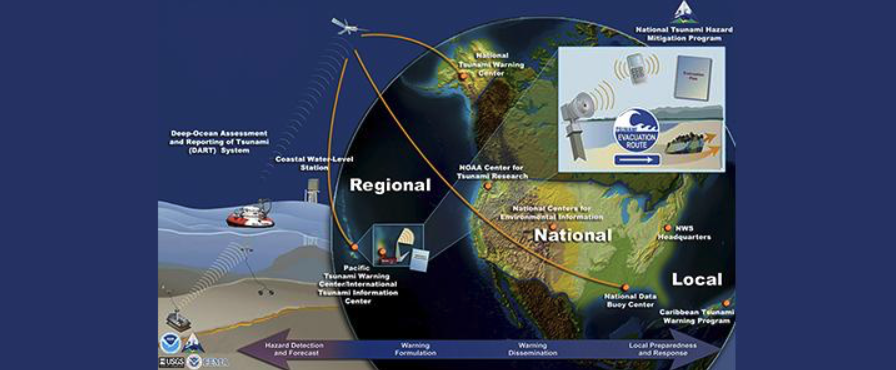
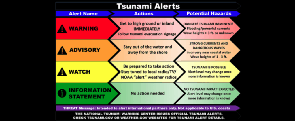
The U.S. has sophisticated warning systems for these disasters, but they have one critical weakness: they work far better when the threat comes from far away than when it’s local. A tsunami from Japan gives you hours to evacuate, but one from a nearby earthquake gives you maybe 15 to 20 minutes. That’s barely enough time to grab your family and run to higher ground. Sirens might never sound. Cell towers could already be down. Your best warning system becomes your own eyes, instincts, and immediate action.
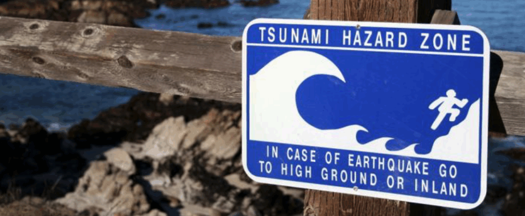
Do This NOW: Critical Warning Signs That Could Save Your Life
If you feel a strong earthquake near the ocean, RUN to high ground immediately. If you see the ocean pulling back from shore, that’s nature’s warning and you have minutes before the wave hits. Resist the urge to investigate the weird low tide because that curiosity kills people. These natural signs are often your only warning. Learn your evacuation routes and practice them regularly. Pick safe meeting places on high ground. Keep emergency supplies ready, including water, food, flashlight, and radio for three days. Emergency preparedness isn’t paranoia but survival.
Scientists Race Against Tsunami Risk Time in the USA
Researchers work frantically to understand tsunami risks and improve warning systems. They’re mapping dangerous underwater landslide zones, studying sediment cores for past event evidence, and installing better monitoring equipment. Scientists are deploying underwater robots, satellites, and geological surveys to gather crucial data. They work closely with communities on evacuation planning because the next overwhelming wave is coming.
When the Next Wave Hits, Will You Survive?
In the USA, the Pacific Northwest faces the highest tsunami risk as the Cascadia fault builds pressure daily. The East Coast faces real danger from underwater landslides and distant earthquakes. The Gulf Coast has lower risk but remains vulnerable to Caribbean sources. Rising seas amplify these risks everywhere. Modern warning systems, research, and preparedness can protect millions, but only if we act now. The next catastrophic surge is coming. Are you ready?
Read More: Ice Melt in Alaska Threatens to Unleash Unprecedented ‘Mega-Tsunami’, Scientists Warn