
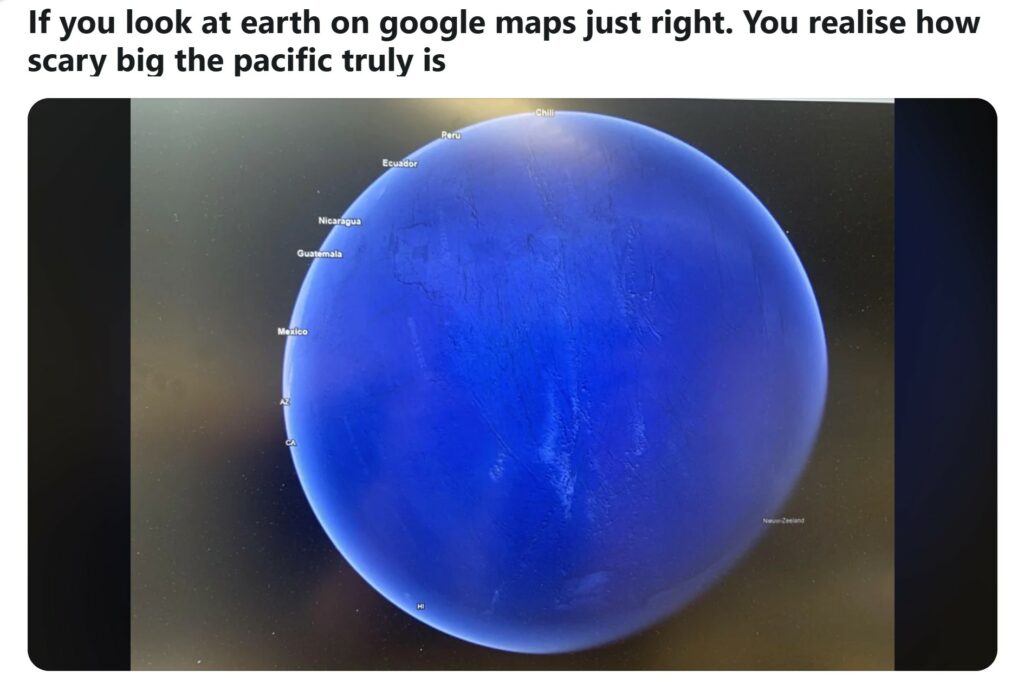
A stunning Google Earth image has gone viral after revealing a rarely seen angle of our planet. It looks almost entirely like ocean. Shared on Reddit’s r/thalassophobia under the post titled “If you look at Earth on Google Maps just right…”, the image shows Earth from above the Pacific Ocean. What’s shocking is how little land is visible. Many viewers say it completely changes how they see the planet.
Instead of focusing on the usual continents like North America or Europe, this view captures Earth from a location that centers the ocean. The result is just a few tiny landmasses- parts of New Zealand and Antarctica- barely visible. The rest of the view is a vast, uninterrupted sea of blue. For many people online, this isn’t just a neat geographic detail. It’s a perspective shift that sparks real emotion.
The Viral Reddit Post That Sparked a Reaction
The image was first noticed by many through a Reddit post in r/thalassophobia, a community centered on the fear of deep water. It makes sense this post caught fire there. This angle of Earth triggers exactly that fear- seeing so much ocean and so little land creates a sense of isolation, even dread. Comments rolled in from people who said it gave them chills. Some called it beautiful. Others called it terrifying.
One Reddit user wrote, “That’s the loneliest part of the planet.” Another joked, “I didn’t need to sleep tonight anyway.” But for all the panic, there was also awe. This image reminded people of how massive the oceans are and how tiny human civilization really is in the grand picture.
Why This View Is So Unnerving
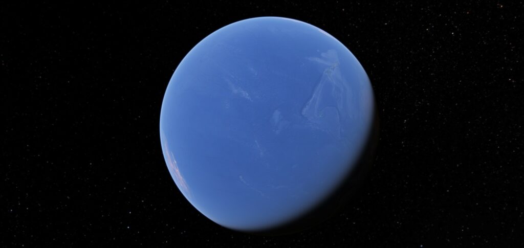
Most people are used to seeing maps that center on land. Globes often place Europe or North America in the middle. That view makes Earth seem like a land-dominated world. But this Google Earth angle reveals the truth. Water rules. From this vantage point, Earth doesn’t even look like it has continents. It’s just deep blue with only small patches of land peeking through.
Earth Is Truly a Water World
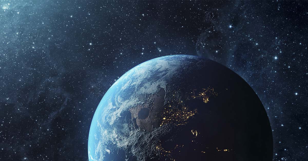
The image proves what science has always told us. Earth is a water world. About 71% of Earth’s surface is covered in water. Most of that, around 96.5%, is found in the oceans. The rest exists in glaciers, underground reservoirs, or floating in the atmosphere. Even though we’re surrounded by water, very little of it is usable for drinking or farming. Less than 1% is easily accessible freshwater. That’s an astonishing fact, especially when your eyes tell you the planet is full of water.
So when people call Earth “the Blue Planet,” they aren’t exaggerating. From space, and especially from this Pacific-centered view, Earth lives up to its nickname. It is blue, bright, and mostly liquid.
The Pacific Ocean: Our Largest Ocean
The Pacific Ocean dominates the image, and for good reason. It is the largest and deepest ocean on the planet. It covers over 63 million square miles. That’s about one-third of Earth’s surface. In fact, it’s bigger than all of Earth’s land combined. It stretches from Asia to the Americas and touches both poles through Australia and Antarctica.
It also holds over half of all Earth’s ocean water. Inside its vast expanse lies the Mariana Trench, the deepest part of the ocean at more than 36,000 feet deep. That’s lower than commercial airplanes fly. The Pacific plays a massive role in shaping weather, driving ocean currents, and regulating the global climate. Seeing it from above in this way helps put its size and influence into perspective.
The Thalassophobia Effect
The image went viral on a subreddit known for discussing fear of deep water, and it’s easy to see why. Even without showing sea monsters or storms, the image is chilling. It’s just pure, open ocean with almost no land to ground you. That emptiness hits something primal in many people.

One person commented that it felt like “floating alone in space.” Another wrote, “Having crossed it on a ship, I can confirm – it feels endless.” That reaction, half wonder and half dread, is what made this image explode in popularity. It taps into a feeling that many didn’t know they had. A fear of just how big and empty parts of our world can be.
A Shift in Perspective
This image is more than just a curiosity. It forces us to rethink our understanding of Earth. We often focus on land like cities, countries, and borders. But this picture reminds us that those things make up a very small part of the planet.
Read More: How 18 Earth Day Predictions from 1970 Failed to Stand the Test of Time
From this view, you see how isolated land truly is. It also shows how little of the planet humans actually occupy. Most of Earth is ocean, uninhabited, and full of mystery. This angle puts that reality front and center. For some, that’s unsettling. For others, it’s humbling.
Science Knew This, But Seeing It Hits Harder
Scientists have always known the ratio of water to land on Earth. Geography lessons teach that 71% of the planet is water. But reading that number isn’t the same as seeing it for yourself.
That’s what makes this image so powerful. It turns a fact into a visual truth. You don’t just learn about Earth. You feel its vastness. NASA has captured similar views from space and even described Earth as a “blue marble.” But tools like Google Earth bring those views to anyone with an internet connection. And with that, the emotional response becomes personal.
The Flip Side: The Land Hemisphere
Interestingly, there’s another side to Earth called the “land hemisphere.” It is centered near France and includes most of the world’s major landmasses. From that angle, Earth looks a lot more familiar. You see Europe, Asia, Africa, and the Americas. But even on the land hemisphere, water still covers about 50% of the view. No matter how you spin it, Earth is more water than land.

This balance reminds us that both perspectives are valid. However, we’re so used to seeing the land-heavy side that the water-dominated angle comes as a shock. It’s a good lesson in why perspective matters.
Why This Matters
This viral image has done more than get likes and comments. It’s made people think and changed how some see the world. It’s opened discussions about how we view geography, nature, and ourselves. And it has reminded us of how powerful visual information can be.
At a time when technology often disconnects us from nature, this image reconnects us. It doesn’t show a city, a war, or a political boundary. It shows Earth as it really is. Raw, real, and overwhelming. That’s why people are freaking out. That’s why it matters.
Conclusion: A Picture That Changed Minds
The now-famous Google Earth image showing Earth from the Pacific has left a lasting impression. It challenges our land-based thinking and brings the planet’s oceanic power into focus. For many, it’s been eye-opening. For others, unsettling. But one thing is certain. It’s unforgettable. You can go take a look for yourself at Google Earth.
This image reminds us that Earth is not just where we live. It’s a massive, living system, mostly made of water and shaped by forces far bigger than us. Whether it inspired fear, curiosity, or admiration, the viral angle got people to see the planet differently. And maybe that’s the best lesson of all.
Read More: Mysterious ‘Lost City’ Discovered Deep in the Atlantic Unlike Anything on Earth