
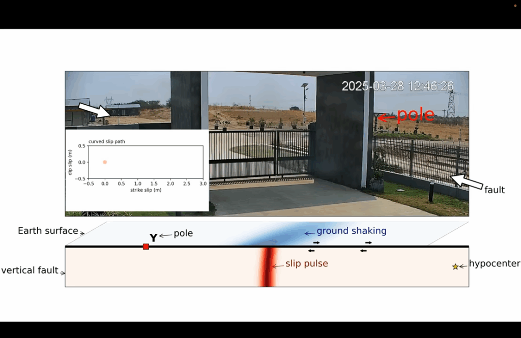
A CCTV security camera along Myanmar’s Sagaing Fault near the town of Thazi captured something extraordinary on March 28, 2025, the exact moment the ground ruptured during a devastating magnitude 7.7 earthquake. The camera, positioned about 75 miles south of the earthquake’s epicenter, recorded what no scientist had ever seen before. Within days, the footage reached geophysicist Jesse Kearse at Kyoto University, who immediately recognized what he was seeing.
“I saw this on YouTube an hour or two after it was uploaded, and it sent chills down my spine straight away,” Kearse recalls. “It shows something that I think every earthquake scientist has been desperate to see, and it was just right there, so very exciting.”
What the Video Shows
Kearse and his colleague Yoshihiro Kaneko analyzed the footage frame by frame using advanced computer techniques that track pixel movements. What they found was that the video captured the actual dynamics of how fault rupture occurs during an earthquake. Confirming decades of theoretical understanding.
The earthquake struck near Mandalay, Myanmar’s second-largest city and home to 1.2 million people, at 12:50 p.m. local time. At a shallow depth of about six miles, the quake amplified destruction across the region. The intense shaking was felt as far away as Bangkok, Thailand. The United States Geological Survey (USGS) immediately issued a Red alert, indicating that both fatalities and economic losses would be severe and widespread. Initial reports indicated thousands killed, with the final death toll eventually exceeding 5,700 people. The rupture tore 290 miles along the Sagaing fault.
The devastation was terrible. Yet the earthquake also opened a window into fault mechanics. Scientists had long suspected that blocks of rock rotate slightly as they move past each other during faulting. Curved scrape marks on fault planes suggested as much, but it was the first time watching it happen in real time.
The Numbers Behind the Rupture
The fault slipped 8.2 feet in just 1.3 seconds. It reached peak speeds of 10.5 feet per second. To put that in perspective, that’s faster than most people can run, and the ground moved the length of a car in barely over a second.
The video captured something even more fascinating about how the rupture moved. Instead of sliding in one smooth direction like scientists expected, the fault motion followed a curved path at first. During the initial half-second, the ground didn’t just slide sideways. It also lifted about a foot before settling into pure sideways motion.
This matches what seismologists had theorized. The earth breaks first where it’s weakest, which is usually at the surface. Then the crack follows the path of least resistance deeper underground.
Proving What Scientists Suspected
Before this video, seismologists had to piece together what happened during earthquake ruptures along faults by studying the aftermath. They would examine scratches and grooves carved into rock faces, called slickenlines, weeks or months after earthquakes. These geological clues hinted at curved motion, but they lack timing and typically capture only a fraction of the total slip that occurred.
The video also validated instrument readings from earthquake monitoring stations. Scientists had been using data from these stations to understand how faults move, but they weren’t sure if those distant measurements accurately reflected what was happening right at the fault. When they compared the Myanmar video to readings from a monitoring station less than two miles away, the numbers matched almost perfectly. Scientists can now trust these instrument readings as accurate representations of fault behavior.
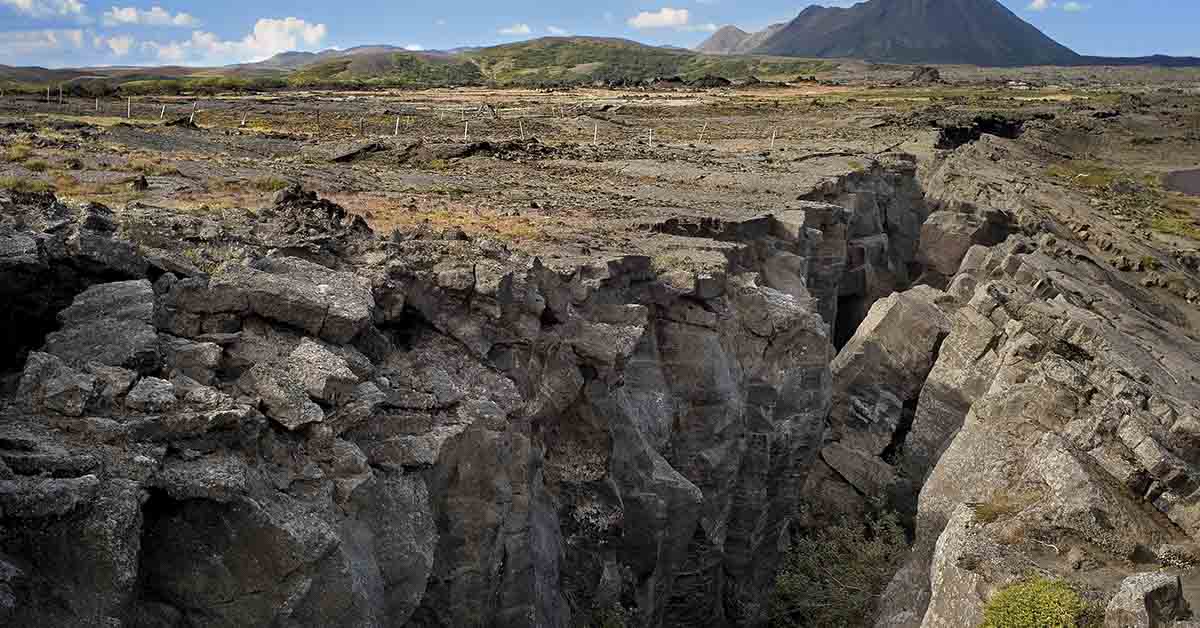
Myanmar sits on one of the world’s most active earthquake zones. Since 1900, six other magnitude 7 earthquakes have shaken the broader region of the Sagaing fault, most recently in 1990. This 2025 earthquake was the most powerful to hit Myanmar in over a century. Now, this video helps explain why this region keeps generating such powerful quakes. It gives scientists their first real-time look at the physical forces that drive these repeated ruptures.
Why This Changes Everything
“This video record provides the first direct observations of how a fault moves during a real earthquake,” Kearse and Kaneko conclude in their analysis published. The observations establish “a new standard for understanding how ruptures work.” As the break moved southward past the camera, the footage matched predictions about how the ground should move. Scientists had theorized that the side of the fault moving in the same direction as the rupture would temporarily lift compared to the other side. That’s exactly what the video showed.
Beyond confirming existing theories, the video opens new possibilities. Direct observation of how faults move could help researchers build better models of earthquake behavior and energy spread. These improvements could enhance earthquake preparedness and risk reduction strategies.
The footage also confirmed how slickenlines form during earthquakes. This validates geological evidence that seismologists have studied for decades. The connection between watching an earthquake happen and finding the scratches it leaves behind strengthens confidence in interpreting evidence from ancient earthquakes as well.
What Comes Next for Earthquake Research
Scientists are now using the footage of the rupture that happened on Myanmar’s Fault to refine earthquake models and test long-standing theories. They hope to apply what they’ve learned to other faults worldwide and improve early warning systems. Plans are also underway to install more cameras along active fault lines, aiming to capture similar footage in the future. What was once a lucky find could soon become a regular part of earthquake research.
Read More: Japan’s New Undersea System Detects Earthquakes 20 Seconds Before Landfall