
Most of us learned the same list in school: seven continents, give or take a geography teacher’s preference for merging Europe and Asia. Africa, Antarctica, Australia, Asia, Europe, North America, South America. Done. Settled. Move on. But geology, it turns out, doesn’t care much about what ended up in the textbooks.
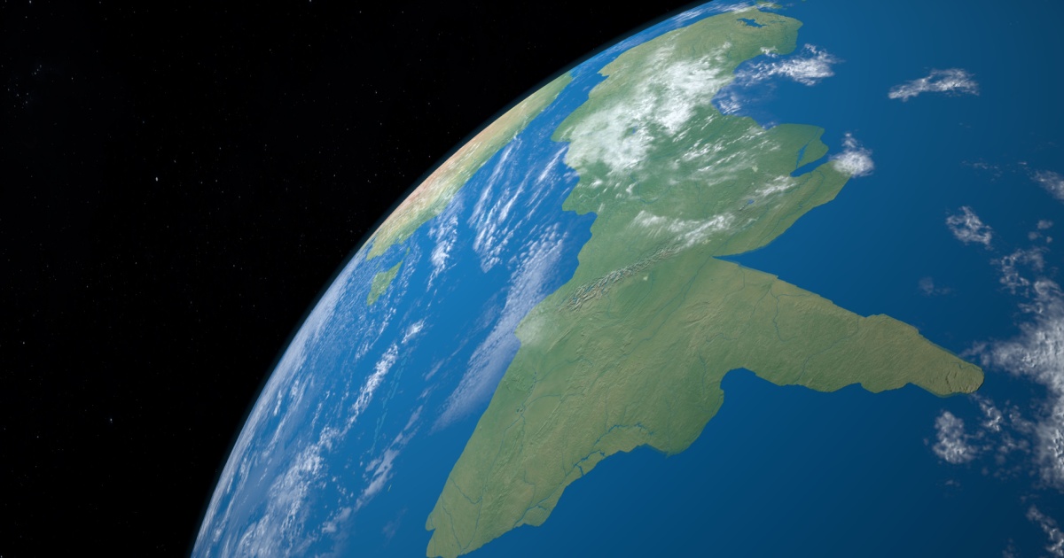
Somewhere beneath the South Pacific Ocean, submerged under more than a kilometer of seawater, lies a landmass bigger than India. It has mountains, sedimentary basins, and ancient rock formations that tell a story stretching back tens of millions of years. For a very long time, scientists debated what exactly to call it. The debate is now over.
Earth, it appears, has an eighth continent. Its name is Zealandia, and it has been hiding in plain sight the entire time.
What Zealandia Actually Is
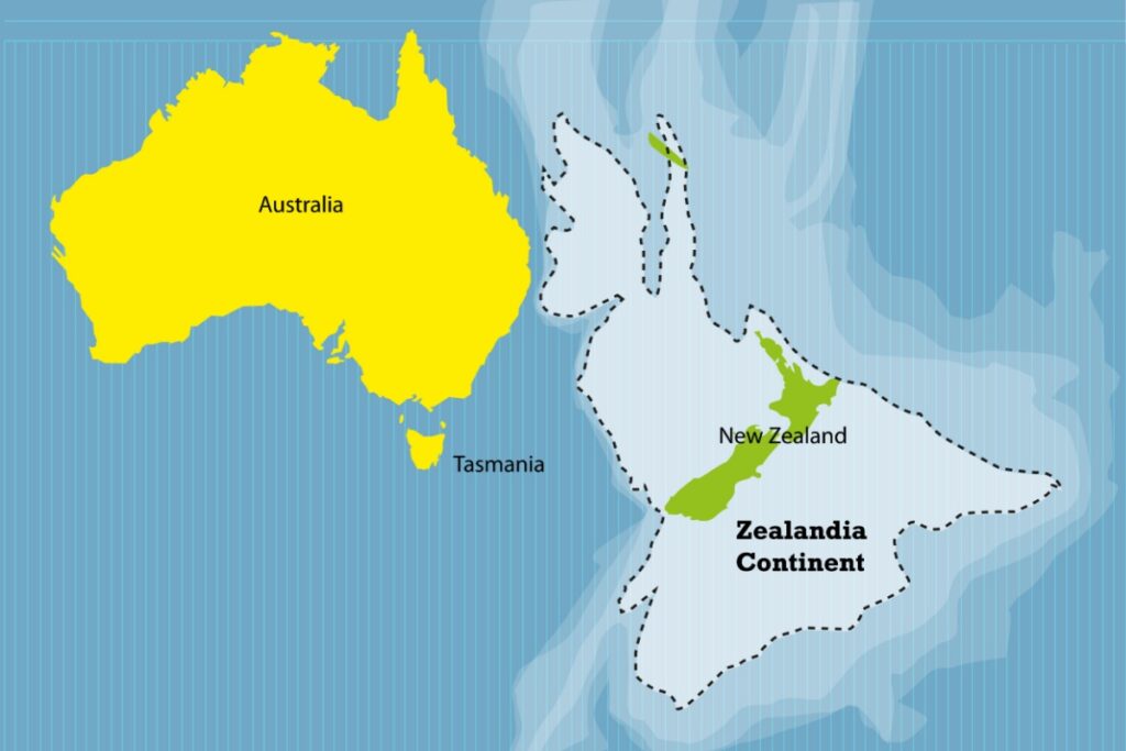
The scale of it alone is hard to wrap your head around. Geologists confirmed the existence of Zealandia beneath the South Pacific Ocean, a submerged landmass covering approximately five million square kilometers, with ninety-five percent of its surface beneath the waves. To put that in context, at nearly two million square miles, this submerged continent is larger than India and almost two-thirds the size of Australia.
The only parts you can actually stand on are the islands that poke above sea level. Only a few islands, including New Zealand and New Caledonia, break the surface. The confirmation comes after years of rock dating, magnetic data analysis, and tectonic mapping.
What separates Zealandia from a random chunk of submerged crust is its geology. Oceanic crust, the kind that makes up the floor of most oceans, is typically thin, dark, and volcanic. Zealandia is different. Scientists from GNS Science emphasized that the landmass meets all four criteria used to define a continent: elevation above surrounding oceanic crust, unique geological features, a coherent landmass, and a crust significantly thicker than that of the ocean floor. Unlike oceanic crust, which typically measures 7 kilometers thick, Zealandia’s continental crust averages around 20 kilometers. It features granitic rocks, schists, and sedimentary basins, characteristics typical of continental geology.
A Continent That Sank
The story of how Zealandia ended up underwater starts long before humans existed. Zealandia’s formation is linked to the ancient supercontinent Gondwana, which, more than 100 million years ago, included the present-day territories of South America, Africa, Antarctica, Australia, and parts of Asia. About 85 million years ago, Zealandia began to separate from Gondwana and initially remained above sea level. Over millions of years, tectonic forces thinned the crust of Zealandia, ultimately pulling most of the continent beneath the ocean’s surface.
The key to understanding why it sank lies in the physics of crust and buoyancy. The ridges are continental rock, but are lower in elevation than normal continents because their crust is thinner than usual, approximately 20 km thick, and consequently, they do not float so high above Earth’s mantle as that of most landmasses. Think of it like a raft that’s been stretched thin. The thinner the material, the less it floats.
As it drifted, the crust stretched and thinned. Thinner crust is less buoyant, so the land began to sink. The process unfolded gradually over millions of years, driven by tectonic forces rather than any single catastrophic event.
There’s also a geological scar from the breakup. Researchers found “a large fault zone along the south border of Zealandia,” likely a scar in Earth’s crust formed when Zealandia broke off from Antarctica and Australia. “During this process, the continental crust was stretched and thinned out.”
How Scientists Finally Proved It
Suspicions about Zealandia go back much further than most people realize. In 1642, Dutch explorer Abel Tasman sailed in search of Terra Australis, a hypothetical southern continent. His route led him to the coast of New Zealand, and while he didn’t recognize the full extent of what lay beneath, Tasman unknowingly passed above a submerged continental shelf.
Centuries later, Sir James Hector, a 19th-century Scottish geologist, presented evidence in 1895 that New Zealand was the remnant of a submerged continental ridge. His insights were largely ignored at the time but are now viewed as early proof of Zealandia’s existence.
The modern name came in the 1990s. The term Zealandia was introduced in 1995 by geophysicist Bruce Luyendyk, a professor of marine geophysics at the University of California, Santa Barbara, who argued that the large submerged area surrounding New Zealand formed a single, coherent continental structure. But naming something and proving it are two very different things.
The formal scientific case was made in 2017, when a landmark study published in GSA Today, the journal of the Geological Society of America, laid out the full geological argument. According to that paper, Zealandia meets all four key criteria for continent classification. It has a distinct elevation relative to the ocean floor, contains a wide variety of continental rocks, sits on a thicker crust than oceanic plates, and has a well-defined geological structure.
The researchers were direct in their conclusion. The scientists wrote: “The scientific value of classifying Zealandia as a continent is much more than just an extra name on a list.” They noted that “a continent can be so submerged yet unfragmented” makes it useful for exploring how continental crust holds together and breaks apart.
The Drilling That Changed Everything
Publishing a case in a journal is one thing. Testing it with physical evidence drilled from the ocean floor is another. That test came in 2017, when an international team took to the Pacific aboard the JOIDES Resolution, a scientific drillship operated as part of the International Ocean Discovery Program.
Expedition scientists drilled deep into the seabed at six sites in water depths of more than 1,250 meters. They collected 2,500 meters of sediment cores from layers that record how the geography, volcanism, and climate of Zealandia have changed over the last 70 million years.
What came up from those cores was striking. According to ScienceDaily, “more than 8,000 specimens were studied, and several hundred fossil species were identified.” The discovery of microscopic shells of organisms that lived in warm shallow seas, and of spores and pollen from land plants, revealed that the geography and climate of Zealandia were dramatically different in the past.
In other words, Zealandia wasn’t always underwater. Parts of it once hosted living ecosystems, with plants and shallow-water creatures thriving on and near a landmass that has since disappeared beneath the waves. In New Zealand and the Chatham Islands, bones from sauropods, ankylosaurs, and possibly even allosaur-like dinosaurs have been discovered. These species lived after Zealandia had broken away from Gondwana, implying that some sections remained habitable for millions of years.
The timeline of when exactly it fully submerged remains open. Some geologists suggest it was fully underwater around 25 million years ago, while others argue intermittent land exposure persisted far longer.
Mapping the Boundaries
More recent work has focused on defining exactly where Zealandia ends and the open ocean floor begins. This is harder than it sounds when most of the subject is sitting under thousands of meters of seawater.
Using geochronology methods, which determine the age of rocks based on measuring radioactive decay, researchers mapped the main geological units of northern Zealandia. By collecting rock samples, including basaltic lavas, sandstone pebbles, cobbles, mudstones, and bioclastic limestones, they traced a timeline of the geological formation of the region. “By dating these rocks and studying the magnetic anomalies they presented, we were able to map the major geological units across North Zealandia,” the researchers explained.
Magnetic data proved especially useful. The analysis of changes in Earth’s magnetic field recorded in Zealandia’s crust helped mark the continent’s boundaries. The combination of magnetic anomalies and rock ages revealed geological patterns that reflect those observed in known continents. The structural coherence across the northern half of Zealandia provided strong evidence of its continental nature.
Mapping of the continent’s full extent concluded in 2023. With a total area of approximately 4,900,000 km², Zealandia is substantially larger than any features termed microcontinents or continental fragments.
For readers curious about how plate movement shapes our planet on a much shorter timescale, the fastest-moving continent on Earth offers an equally surprising story from the same part of the world.
Why This Discovery Actually Matters
Calling Zealandia a continent isn’t just a matter of updating world maps, though that alone would be remarkable. The scientific implications run deeper.
A continent this large, this submerged, and yet this structurally intact gives geologists a rare opportunity to study how continental crust behaves under prolonged tectonic stress without fragmenting. Most continents either stay above water or break apart as they sink. Zealandia did neither, and that makes it scientifically unusual.
Scientists find Zealandia valuable for learning how continents evolve under changing plate conditions. This sunken landmass preserves clues about Earth’s past that aren’t visible on continents above the surface.
There are also practical stakes. The United Nations Convention on the Law of the Sea offered new incentive: if New Zealand could prove Zealandia was part of its continental shelf, it could claim vast undersea economic rights. The seabed itself holds resources too. Zealandia supports substantial inshore fisheries and contains gas fields, of which the largest known is the New Zealand Maui gas field, near Taranaki. Permits for oil exploration in the Great South Basin were issued in 2007. Offshore mineral resources include iron sands, massive volcanic sulfides, and ferromanganese nodules.
Then there’s the question of what this tells us about biodiversity. As expedition co-chief scientist Rupert Sutherland of Victoria University of Wellington noted, “big geographic changes across northern Zealandia, which is about the same size as India, have implications for understanding questions such as how plants and animals dispersed and evolved in the South Pacific.” The discovery of past land and shallow seas “provides an explanation. There were pathways for animals and plants to move along.”
Read More: Scientists Uncover Two Massive Mystery Structures Hidden Beneath Africa
What This Means for How We Understand Earth
Most of us grew up with a picture of Earth that felt complete. Seven continents, four oceans, a planet fully known and catalogued. Zealandia is a reminder that the planet’s full story is still being written, and that the absence of something from a map doesn’t mean it doesn’t exist.
There is no single, universally accepted definition of a continent, and geographers and geologists differ on the question. Geographically, Europe and Asia are considered separate continents, whereas geologists consider them the single landmass of Eurasia. That ambiguity is exactly why cases like Zealandia matter. They force a reckoning with definitions that were always fuzzier than they appeared in school textbooks.
Large portions of Zealandia remain unexplored. Technologies like seismic imaging and deep-sea drilling will likely uncover more details of its structure and past. Some investigators hope to find further clues about how drifting continents influence sea level, climate patterns, and the distribution of plants and animals across the Southern Hemisphere. As Dr. Nick Mortimer of GNS Science has put it, Zealandia’s underwater status in no way diminishes its geological significance.
The next time you look at a world map, remember that the picture is incomplete. Beneath the blue expanse of the South Pacific, a continent the size of India is quietly sitting there, waiting for the rest of its secrets to be pulled to the surface. And given how long it took for scientists to even agree it existed, it’s a fair bet the discoveries to come will be just as surprising as the continent itself.
AI Disclaimer: This article was created with the assistance of AI tools and reviewed by a human editor.
Read More: Africa May Be Splitting Apart — Scientists Just Found the Proof Bubbling Up in Zambia