
Something big is stirring in the Pacific Ocean, and weather forecasters are watching it more closely than almost anything else right now. Sea surface temperatures near the equator are climbing fast, a massive pool of abnormally warm water is massing just beneath the surface, and the models that meteorologists rely on keep revising their forecasts in one direction only: stronger. What started as a fairly standard seasonal outlook has quietly become one of the most closely watched climate stories of 2026.
The term “Super El Niño” isn’t an official scientific category, but it’s become shorthand for something very real. A weak El Niño develops once water temperatures climb 0.5 degrees Celsius above average, but water temperatures must exceed 2 degrees above average for an event to be considered very strong or “super.” That threshold has only been crossed a handful of times in the modern record. El Niño is a natural climate phenomenon, typically lasting 9 to 12 months, that has been linked to crop failures, more frequent wildfires and concurrent droughts, increased flood risk, disruptions to fisheries, and elevated disease risk in various regions. But a super-strength version of this pattern doesn’t just bend the weather slightly. It reshapes it, sometimes for years.
The question most Americans should be asking right now isn’t whether this affects them. It’s where, and how badly. Some parts of the country are about to get hit far harder than others, and the super El Niño impacts on certain regions could be unlike anything those communities have dealt with in decades. Here are the five US regions with the most to brace for.
1. California and the West Coast
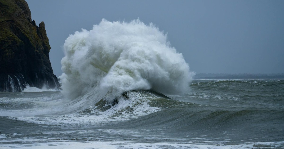
California is always the wildcard during El Niño years, and that uncertainty cuts both ways. The 1997-98 super El Niño brought devastating floods to California, but the 2015-16 event mostly missed the state entirely – same classification, completely different outcomes. That unpredictability makes preparation difficult, but the risk this time around is serious enough that coastal communities aren’t waiting to find out.
Strong El Niño events historically bring 150 to 200 percent of normal rainfall to parts of California. For some areas, that translates to potentially 40 to 50 inches of rain versus a typical 14 inches around Santa Barbara. When storms arrive in that volume, rivers overflow. Flooding risks rise sharply for the Salinas River, San Luis Obispo Creek, and other typically flood-prone areas, while coastal zones face higher tides and elevated wave action.
The ocean-level threat is just as significant as the rainfall one. Scientists have warned that a super El Niño could produce a temporary sea level rise of around 6 inches in California. That figure needs to be added on top of existing climate change-caused sea level rise, which ranges from about 6 inches to a foot over the past century depending on location. Warm ocean temperatures associated with El Niño can also trigger harmful algal blooms and disruptions to marine food webs, compounding the ecological strain on coastal communities. According to AccuWeather Senior Meteorologist Chad Merrill, El Niño could combine with a marine heat wave off the West Coast to produce more thunderstorms than typical for Southern California, with dry thunderstorms in mid to late June capable of igniting wildfires before shifting to moisture-laden storms that bring localized flash flooding by midsummer. If you live near the California coast, this winter’s risk isn’t one single storm. It’s a series of compounding pressures arriving together.
2. The Pacific Northwest and Super El Niño Impacts on Fire Risk
Washington, Oregon, and their neighbors to the north and east face a fundamentally different kind of threat from El Niño. Where California worries about too much rain arriving too fast, the Pacific Northwest worries about too little arriving at all, and what that means when summer comes around.
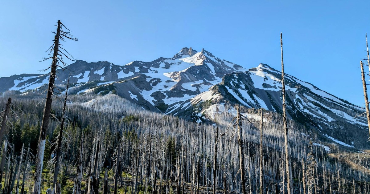
AccuWeather meteorologist Chad Merrill explained that a consequence of El Niño is a hotter and drier pattern in the Northwest US that can lead to large wildfires, with severe drought potentially expanding across more of the Northwest into the northern Rockies during El Niño summers that transition to a strong or very strong event by fall. That pattern is already visible in the data before the event has even fully formed. The Pacific Northwest faces the highest risk of reduced snowpack, early melt, and an expanded wildfire season, with Washington having declared drought emergencies for four consecutive years.
Snowpack in Washington is already sitting at roughly 50 percent of normal. That matters enormously because mountain snowpack acts as a slow-release water reservoir. When it’s low, rivers and reservoirs get less water through spring and summer, the very months when soil becomes dry enough to burn. If El Niño brings warmer, drier conditions as expected, eastern Washington, Montana, and Idaho could face critically low soil moisture through July and August. AccuWeather’s 2026 summer forecast identifies California, Idaho, Montana, Nevada, Oregon, Utah, Washington, and Wyoming as the states where the worst of the heat will concentrate, fueling a widespread fire threat.
Read More: What Wildfire Smoke Does to Your Lungs
3. Arizona and the Desert Southwest
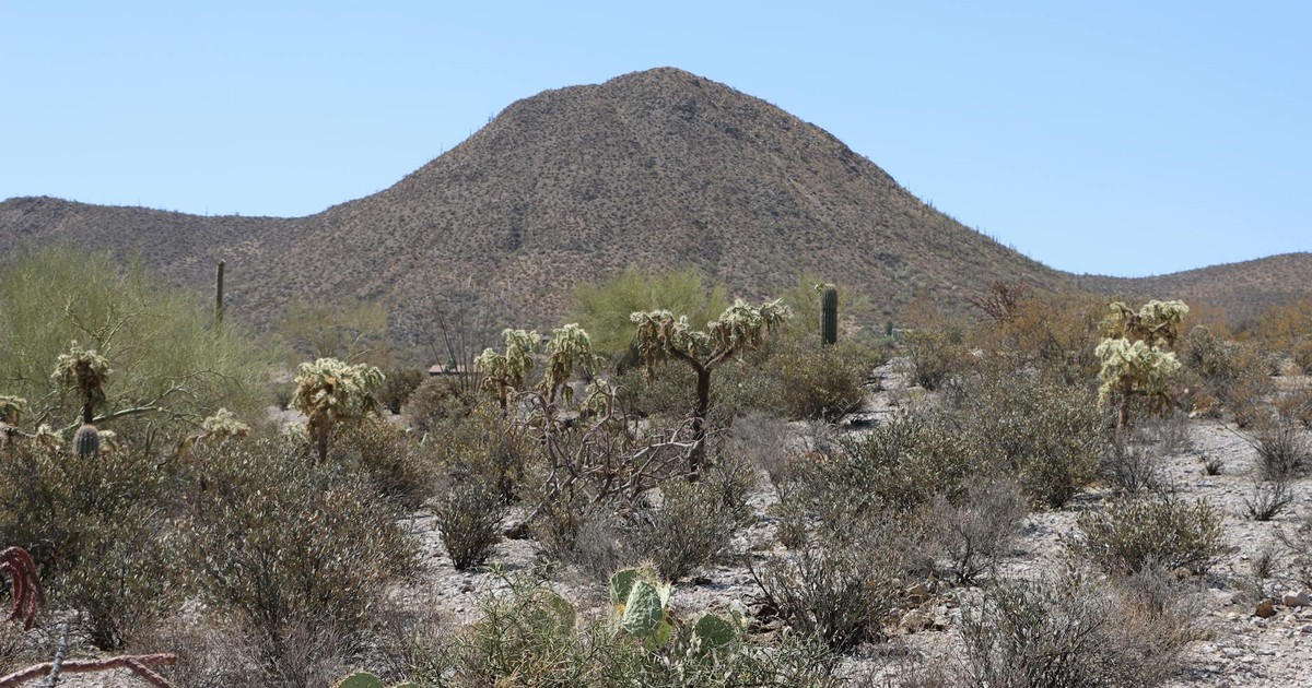
Arizona enters 2026 already under serious strain, and a super El Niño may be the worst thing that could happen to it this year. The state’s challenge isn’t just about rainfall or the lack of it. It’s about compounding heat on top of already exhausted land.
Forecasters have warned that Arizona may be in for more record heat, deadly floods, and intense wildfire activity, with a strong El Niño forecast to further amplify those risks. The drought picture in northern parts of the state is particularly grim heading into the season. A super El Niño event can lead to more extreme weather shifts, turning normal seasonal changes into high-impact events such as massive flooding, severe droughts, severe storms, and significantly altered pressure system tracks.
The wildfire risk in Arizona deserves its own focus. The fast-warming tropical Pacific is pointing toward a major event, but the interactions involved are notoriously complex and difficult to predict, making it too early to confidently forecast exactly how powerful this El Niño will become. What climate scientists do know is that the conditions on the ground in Arizona are already precarious. Drought-weakened forests have more dead and dry fuel available. According to AccuWeather’s 2026 wildfire forecast, the monsoon may bring some short-term relief to the Southwest, but it could also trigger flash flooding, mudslides, and lightning-sparked fires. That’s the cruel irony of El Niño in the desert: the moisture, when it does arrive, can be as destructive as the drought that preceded it.
Climate scientists predict that storms will be particularly strong as the effects of El Niño compound with the effects of climate change. As UCLA climate scientist Daniel Swain noted in a 2026 briefing, “in modern human history, we’ve never experienced a strong or very strong El Niño event amid pre-existing conditions that were this warm globally.” For Arizona residents, having a plan ready for both wildfire evacuation and flash flooding isn’t an overreaction. This season, it’s basic preparedness.
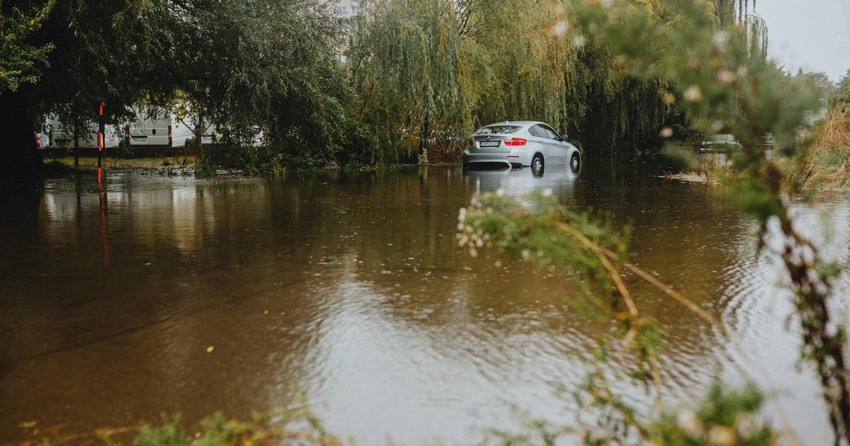
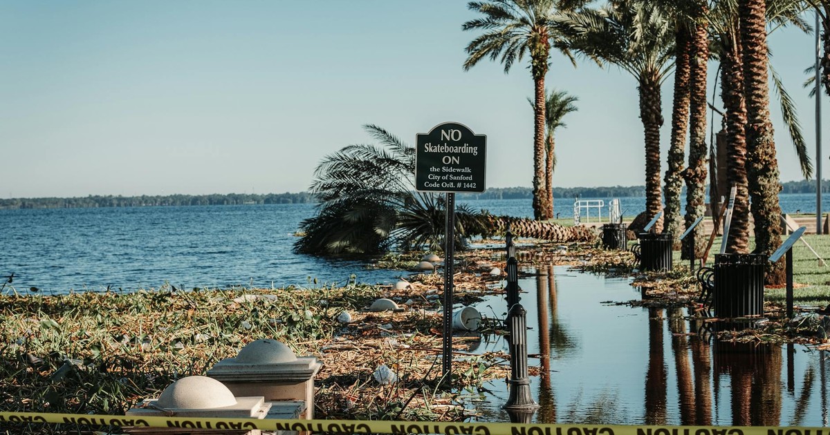
4. Texas and the Gulf Coast

Texas and the Gulf Coast sit in a genuinely different position from the Western states, and it’s worth understanding why. Where El Niño tends to dry out the Pacific Northwest, it typically does the opposite along the southern tier of the country. That’s mostly good news for a region that has endured years of drought, but it comes with a catch.
A warmer-than-average winter is typical from the northern US into Canada during El Niño, while the southern tier of the country is often wetter and cooler as a beefed-up jet stream steers more storms across this region. Data from drought.gov suggests El Niño could actually break six years of drought in the Southern Plains, with the same El Niño that worsens fire risk in the Northwest potentially rescuing agriculture in Texas and Oklahoma. That’s a real benefit, and one that shouldn’t be dismissed.
The problem is the delivery. Meteorologists warn that a strengthening super El Niño pattern could bring widespread flooding, especially in Houston and nearby flood-prone areas, raising concerns that early weather events may be a preview of a wetter season ahead. More than 322,000 homes in the Houston area alone sit within floodplains, making them particularly vulnerable to even moderate rainfall events. Along the Atlantic coast, the shift in the jet stream often steers storms toward the mid-Atlantic, resulting in more storm surge events, while higher-than-normal rain can also occur along the US Gulf and Southeast coasts. The risk for Texas and Louisiana isn’t simply rain. It’s what happens when rain comes in bursts heavy enough to overwhelm drainage infrastructure that was already strained before El Niño arrived.
5. The Southeast and Florida
Florida and the broader Southeast find themselves in a complicated position during strong El Niño years. Moderate to strong El Niño events produce widespread wet weather across the southern tier, especially California, the Gulf Coast, the Southeast, and Florida. In one sense, this means the Atlantic hurricane season gets quieter, which is genuinely good news for a coastline that has absorbed devastating storms in recent years.
Stronger El Niños often produce storm-killing conditions in the Caribbean and tropical Atlantic, resulting in fewer tropical storms and hurricanes in those waters. Historical data shows a notable increase in hail reports across the Southwest and Florida during summers in developing super El Niño years, while much of the Northeast and Gulf Coast region experiences a decrease in hail activity compared to the long-term average. NOAA’s official 2026 Atlantic hurricane season forecast predicts a below-average season with 8 to 14 named storms, compared to the historical average of 14, a direct reflection of El Niño’s suppressive effect on Atlantic storm formation.
But suppressed hurricane activity doesn’t mean the Southeast gets off lightly. According to the same Newsweek reporting on Chad Merrill’s forecasts, stretches of dry weather could lead to prolonged moderate to severe drought from the I-81 corridor in the mid-Atlantic into the Southeast, while rain – when it does arrive – may come in large quantities over a short time period with little percolation into soil. That agricultural stress matters. El Niño-driven ocean conditions can also trigger harmful algal blooms and disruptions to marine food webs, adding strain to coastal ecosystems along the Southeast’s extensive coastlines. Public health risk is another dimension worth taking seriously. El Niño has been linked to increased flood risk, disruptions to fisheries, and elevated disease risk in various regions, and the wetter, warmer winters projected for the Southeast create conditions favorable for the spread of vector-borne illness.
What This Means for You

According to NOAA’s Climate Prediction Center, El Niño is likely to emerge soon, with an 82% chance in May through July 2026, and a 96% chance of continuing through Northern Hemisphere winter 2026 into 2027. Current forecasts show a strong El Niño developing into 2026 that could easily exceed the super El Niño threshold of plus 2 degrees, potentially pushing into the extreme event range. Forecasters are careful to note the uncertainty, but the trajectory of the models keeps pointing in the same direction. Even a weaker event now unfolds in a world transformed by climate change, with extra heat and moisture loading an already feverish atmosphere and oceans, meaning El Niño’s impacts could become more extreme even if the phenomenon itself doesn’t break records.
The practical takeaway varies by region. If you’re in California or the Pacific Northwest, now is the time to check flood insurance, review evacuation routes, and take wildfire preparedness seriously before the summer fire season peaks. If you’re in Arizona or the desert Southwest, a dual plan for both drought-driven fire and flash flooding isn’t excessive – AccuWeather’s wildfire forecast projects 5.5 to 8 million acres burned nationally in 2026, with Arizona and the broader Southwest identified as ground zero for the worst of it. If you’re in Texas, along the Gulf Coast, or in the Southeast, understand that wetter winters bring flooding risk as much as drought relief. Communities in floodplains should take that exposure seriously now, not after a storm has already arrived. Wherever you are in the country, the super El Niño impacts of 2026 into 2027 are not a distant forecast. They are already taking shape, and the window to prepare is open right now.
AI Disclaimer: This article was created with the assistance of AI tools and reviewed by a human editor.
Read More: This Year’s ‘Super El Niño’ Could Rewrite Climate Records – What Scientists Are Saying