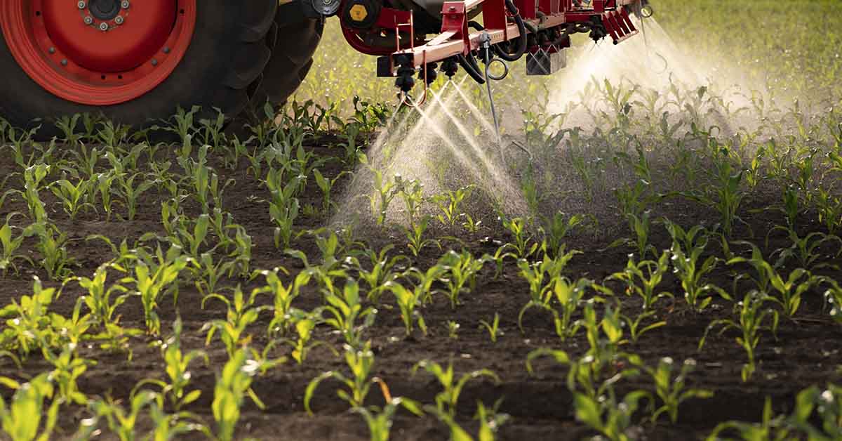

A newly released pesticide usage map paints a troubling picture of chemical reliance in the United States. This data-rich visualization, compiled from the Environmental Protection Agency and the U.S. Geological Survey, pinpoints the states with the highest pesticide use. It shows where harmful chemicals saturate farmland and threaten nearby communities. While these substances play a role in boosting crop production, they also introduce serious health and environmental risks.
Unlike many international counterparts, the United States continues to rely on pesticides that scientists have linked to cancer, hormonal disorders, and neurological diseases. Yet public awareness remains low. In fact, communities living near treated fields often face constant exposure without fully understanding the dangers. That’s why environmental groups have labeled this crisis “America’s silent poisoning.”
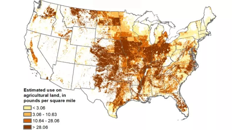
Fortunately, the pesticide usage map now brings visibility to a problem that has remained hidden for too long. With its help, we can finally see where chemicals are most heavily used, which communities are affected, and what needs to change.
States with the Heaviest Pesticide Load
Not all states contribute equally to the problem. The pesticide usage map reveals that chemical-intensive farming is concentrated in a handful of regions. These states grow crops like corn, soybeans, cotton, and citrus that require repeated chemical treatments to prevent pests and weeds from destroying yields.
As a result, the top 10 states with highest pesticide use include:
- California
- Texas
- North Carolina
- Florida
- Illinois
- Iowa
- Washington
- Nebraska
- Indiana
- Arkansas
California clearly leads the list. Its Central Valley, a vital hub for fruit and vegetable production, absorbs enormous quantities of herbicides and insecticides. Similarly, Midwestern states like Illinois and Iowa apply large volumes of chemicals to support corn and soybean farming. Meanwhile, Florida and Texas use pesticides extensively for citrus and cotton crops.
In many counties across these states, over 100,000 pounds of toxic chemicals are applied each year. This massive volume raises urgent questions about environmental safety and the long-term health risks of pesticide exposure for local residents.
Read More: Your Olive Oil Might Be Fake – Here’s How You Can Tell
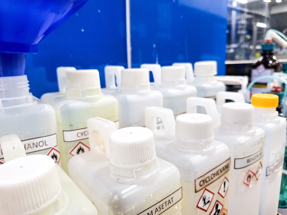
What’s Being Sprayed: The Most Concerning Chemicals
Along with identifying high-use regions, the pesticide usage map sheds light on which chemicals dominate American agriculture. Alarmingly, many of the most commonly used pesticides in the U.S. have long histories of serious health concerns.
For example:
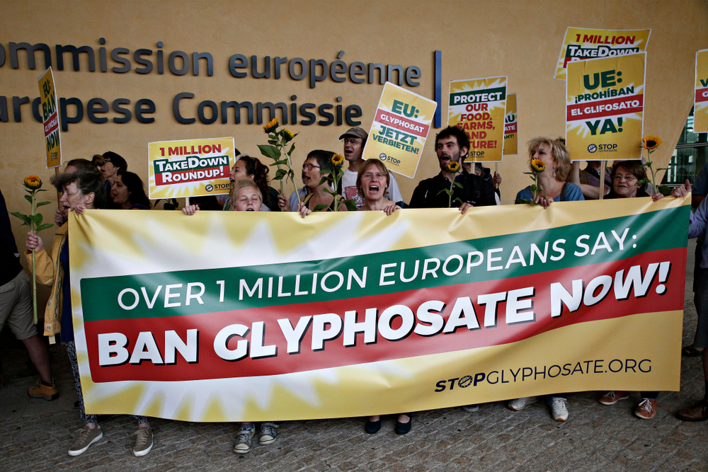
- Paraquat is highly toxic and linked to Parkinson’s disease. Although more than 50 countries have banned it, U.S. farms still apply it regularly.
- 2,4-D, once used in Agent Orange, is associated with immune system problems and certain cancers.
- Glyphosate, best known as the active ingredient in Roundup, is the world’s most widely used herbicide. Studies and lawsuits have connected it to non-Hodgkin’s lymphoma.
- Chlorpyrifos was banned for food crops in 2022 due to its effect on brain development in children, yet it remains legal for non-food use.
These chemicals don’t remain confined to the fields where they are sprayed. Instead, they drift into the air, settle on neighboring properties, and seep into water supplies. Together, they form a toxic cloud that affects millions, often without their knowledge or consent.
Who Faces the Greatest Danger?
While farmworkers face the most immediate exposure, they are far from the only ones at risk. Pesticides often drift into nearby communities, contaminating air, water, and even schoolyards. As a result, the health risks of pesticide exposure affect a wide range of people, not just those who work in agriculture.
Children, for instance, absorb chemicals more easily and are more sensitive to their effects. Pregnant women and the elderly are also especially vulnerable to long-term damage from exposure. Even short-term contact can trigger respiratory problems, skin conditions, and hormonal disruption.
Moreover, low-income and immigrant families often live and work in regions with the highest pesticide use. These communities typically lack access to clean water, protective equipment, or affordable healthcare. As the pesticide usage map clearly shows, they bear the heaviest burden with the fewest resources.
The result is a deep environmental injustice. Those who contribute the least to chemical use often suffer the most from its consequences.
Why the U.S. Still Allows Dangerous Pesticides
Given the known health risks, many people ask a reasonable question: Why does the U.S. still permit these chemicals? The answer lies in a combination of outdated regulations, industry lobbying, and slow government action.
Unlike Europe and other regions that act swiftly to ban high-risk substances, the United States lags behind. Even when studies reveal a clear link between pesticides and disease, these chemicals often stay on the market for years. Loopholes and weak oversight allow companies to keep selling products that other countries have deemed too dangerous.
The pesticide usage map makes these failures painfully obvious. It shows us where government inaction has allowed harmful chemicals to spread unchecked. As a result, environmental and public health groups are calling for urgent reforms.
What Can We Do About It?
Although the problem is widespread, solutions are within reach. Both policymakers and individuals can take action to reduce harm and create a safer, healthier environment.
Lawmakers should move quickly to:
- Ban the most toxic pesticides, including paraquat and 2,4-D
- Speed up the EPA’s review process and enforce tighter safety standards
- Make real-time pesticide use data public and easily accessible
- Support farmers who adopt organic or regenerative agriculture methods
At the same time, individuals can take meaningful steps:
- Buy organic produce, especially when it comes to high-residue crops
- Rinse all fruits and vegetables thoroughly before eating
- Support local farms that minimize chemical use
- Educate others and advocate for stronger pesticide regulations
By using the pesticide usage map as a guide, we can prioritize efforts where they are needed most. This tool helps communities understand the scope of exposure and push for policies that prioritize public health over profit.
A Clear Warning and a Chance to Act
The pesticide usage map sends a powerful message. Across the U.S., dangerous chemicals blanket farmland, seep into water supplies, and expose families to preventable harm. From California’s Central Valley to the cornfields of Iowa, the evidence is clear: pesticide use has reached unsafe levels in many areas.
However, this challenge is not beyond our control. With greater public awareness, smarter laws, and safer farming methods, we can reverse the trend. The first step is understanding where the danger lies. The next step is deciding to act on that knowledge.
Now that we know which states have the highest pesticide use and how serious the health risks of pesticide exposure truly are, the choice becomes ours. Will we continue down this path, or demand a healthier, more sustainable future?
Read More: Researchers Find Possible Prostate Cancer Link to 22 Pesticides