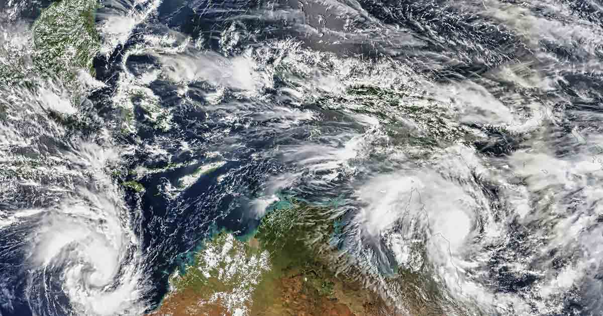

Climate stories rarely arrive with this much tension packed into a single forecast. Across the Pacific, the last traces of La Niña are fading, and forecasters now see a credible path toward El Niño later in 2026. That shift would draw attention in any year, yet this is not any year. The world has just come through a run of extraordinary heat, with oceans holding immense stored energy and global temperatures still hovering near record territory. In that setting, even a developing El Niño carries far more weight than the phrase usually suggests. It is not just a climate label. It is a signal that a major driver of global weather may soon begin adding pressure to a system already under strain.
Even so, scientists are not declaring a super El Niño, and they are not speaking in absolutes. NOAA expects a transition to ENSO-neutral conditions first, then says El Niño is likely to emerge in June through August, with a 62% chance. WMO also says neutral conditions remain the leading near-term outcome before El Niño odds build later in the year. That leaves this story balanced between rising concern and real uncertainty. The forecast has turned serious. The strongest version of the headline has not been confirmed. What scientists are saying, in essence, is sharper and more useful than hype. Watch the Pacific closely, respect the uncertainty, and pay attention to what a warming world could do with one more push.
The forecast is getting warmer, but the evidence still has limits

NOAA’s March 2026 ENSO discussion marks a real turn in the outlook, yet it does not justify certainty. La Niña still lingered through February, with below-average sea surface temperatures across the east-central Pacific. The latest weekly Niño-3.4 reading sat at -0.5°C, showing weaker cooling, not a finished reversal. NOAA expects the leftover La Niña pattern to fade soon. It favors neutral conditions from May to July. After that, El Niño becomes the leading scenario from June to August. NOAA gives that outcome a 62% chance. It also says the event could last through late 2026. IRI’s forecast points the same way, though with its own probabilities and caveats. Its March outlook favors neutral conditions at about 90% for March to May.
El Niño odds then rise quickly after spring. Drought.gov, summarizing NOAA analysis, says about 80% of model runs cross the El Niño threshold by early fall. That combination explains the growing attention. Forecasters are not reacting to a single warm patch on a map. They are watching a broader shift in ocean conditions. Warmer subsurface water can rise and support later surface warming. That hidden heat matters because El Niño often builds from below. The atmosphere usually responds later. The transition signal, therefore, looks real. It also remains incomplete, which is why the official message stays measured. NOAA still lists both a La Niña Advisory and an El Niño Watch. That pairing captures the present moment well. The Pacific is moving, yet it has not finished moving.
Scientists also stress that timing and strength remain harder to pin down than most headlines suggest. NOAA says the potential strength remains “very uncertain” if El Niño forms. The agency gives only a 1-in-3 chance of strong conditions in late 2026. WMO’s March update echoes that caution. It says neutral conditions still look most likely in the near term. It also notes that forecast confidence drops across the boreal spring. That seasonal weakness is known as the “spring predictability barrier,” when model skill often slips. In plain terms, the ocean and atmosphere can change direction more easily during this period. That does not make the forecast empty. It means careful forecasters avoid pretending that June or October is already settled.
The same restraint applies to the phrase super El Niño. NOAA’s official outlook does not use that label. Climate.gov has also noted that upper-end strength thresholds remain unofficial. Scientists can discuss a path toward a strong event. They still separate that possibility from what the data prove today. That distinction matters because seasonal outlooks guide farming, water planning, disaster preparation, and insurance decisions. Those sectors need realistic probabilities, not inflated language. The best reading of the evidence is straightforward. The ocean is warming, and the models increasingly agree on a turn. Yet the strongest version of the story still outruns the evidence available now. Many forecasts improve after spring has passed. That is another reason scientists resist dramatic wording in March. They know the broad direction can be correct while key details still shift.
Record warmth has changed the meaning of a possible El Niño year
Scientists worry about a new El Niño because it would arrive in a climate system already running hot. WMO confirmed that 2024 was the warmest year in the 175-year observational record. The agency put the annual temperature at 1.55°C above the 1850 to 1900 average. WMO then confirmed that 2025 ranked among the three warmest years ever recorded. That result matters because 2025 stayed near the top even with La Niña offering some temporary cooling. The broader trend, therefore, remained powerful. Ocean heat also stayed high, and long-term warming did not pause. WMO said the past 11 years were the 11 warmest on record. That statement shows why scientists now view each natural climate swing through a different lens. El Niño still adds heat through a familiar ocean-atmosphere process.
Yet it now does so on top of a far warmer baseline. A future event does not need to become historic on its own terms to help produce historic outcomes. It can amplify extremes that were already building. It can also stretch warm conditions across seasons that once had more room for fluctuation. That is why current forecast discussions carry more weight than similar outlooks might have carried decades ago. A warming Pacific no longer enters a neutral background. It enters a climate system that has already lost much of its old margin. Even modest extra warming can therefore have larger consequences than it once did. That change helps explain the sharper tone in current scientific discussions. WMO’s climate assessment adds important timing and context to that concern.
It says 2024’s global mean temperature was boosted by a strong El Niño that peaked early in the year. Yet it also says temperatures were already at record levels in 2023. In every month from June 2023 through December 2024, monthly global temperatures exceeded all earlier records for those months. WMO also stresses a point that often gets blurred in public debate. A single year above 1.5°C does not mean the Paris Agreement limit has been permanently breached. That target is measured over decades, not one calendar year. Even so, the practical risk remains serious. When the world starts from such an elevated baseline, extra Pacific warming can tilt several systems at once.
It can influence temperature records, marine heat, glacier melt, crop stress, and public health burdens. Secretary-General Celeste Saulo said the 2023 to 2024 El Niño “played a role” in record temperatures. She also warned that human-driven warming remains the deeper force behind the trend. Scientists, therefore, watch for more than a temperature headline. They look at how El Niño can interact with hot oceans, warm land, and already stressed systems. In that setting, even a merely strong event could produce outsized consequences. The forecast debate is therefore not about hype alone. It is about what added Pacific warming could mean in a climate era that already keeps breaking expectations. It is also about timing, because a late-year warming pulse can influence the following season.
A strong event would shift rainfall risks, but not with equal force everywhere
El Niño does not strike the world like one storm crossing one coastline. It works by altering tropical rainfall, air pressure, jet streams, and storm tracks across vast distances. NOAA’s impact guidance says warm ENSO episodes disrupt the usual pattern of tropical precipitation. That disruption then affects atmospheric circulation features far beyond the equatorial Pacific. The Pacific jet stream often becomes stronger than normal during a warm episode. Storm and frontal paths can then shift, which changes rainfall and temperature patterns in many regions. NOAA’s historical composites show some broad tendencies. Drier conditions often appear over parts of Indonesia, northern South America, and southern Africa during key seasons. Wetter conditions also increase in some other areas. That pattern includes parts of tropical South America and some regions near the southern United States.
As El Niño strengthens, tropical rainfall usually extends farther east across the Pacific. That shift weakens some monsoon circulations in Australia, Southeast Asia, South America, Central America, and Africa. These patterns help scientists build seasonal outlooks. They also help governments prepare for drought, flood risk, crop failures, and fire danger. Yet the maps are guides, not guarantees. Local geography, ocean temperatures outside the equatorial Pacific, and ordinary weather noise can all alter the final outcome. Even a well-forecast El Niño can still produce surprises on the ground. Small shifts in storm tracks can also decide whether one district stays wet while another dries sharply. Such local contrasts often shape the real human cost. Recent experience shows why those odds matter and why caution still matters too.
WMO’s 2024 climate report says some impacts during that year were characteristic of El Niño. It pointed to dry conditions across parts of northern South America and Southern Africa. NOAA’s regional material for Mozambique in March 2026 also links the coming seasonal outlook to the expected ENSO transition. That bulletin notes a likely move to neutral conditions, then a likely El Niño from June to August. Such outlooks matter because communities do not respond to ENSO in the abstract. Farmers care about planting windows, reservoir managers care about runoff, and health agencies care about heat and food security. WMO calls seasonal forecasts “essential planning tools” because they help authorities prepare before losses deepen.
Still, the same WMO reporting also warns that each El Niño differs. It also warns that other climate drivers can change the result. The Indian Ocean Dipole can amplify or blunt the expected pattern. Marine heat in other basins can do the same. Regional circulation quirks can also shift outcomes. That means a future strong El Niño could bring familiar risks without repeating the exact geography of past events. Some areas could match the historical script. Others could break from it sharply. Scientists, therefore, use teleconnection patterns as a planning framework, not a script carved in stone. That distinction explains both the value of the forecast and the caution built into every serious scientific discussion.
The science on future super El Niño risk is active, not settled
Seasonal forecasts answer one question, yet researchers are also wrestling with a harder one. Will global warming make the strongest El Niño events more common, or mainly more damaging when they happen? That debate remains active because the evidence still points in more than one direction. A 2024 Nature paper led by K. Thirumalai argues that a future increase in extreme El Niño is supported by evidence from past climates. The authors say ENSO variability can change markedly across different climate states. Their simulations show larger ENSO variability under greenhouse warming and weaker variability under glacial conditions. That result supports the idea that a warmer world could favor more intense upper-end events. Newer work has also pushed concern higher. A 2025 Nature Communications study led by Aoyun Xue examined high-end El Niño events.
The paper described them as “super El Niño events.” It linked them to climate regime shifts and says global warming is expected to strengthen its impacts. It also says the probability and magnitude of those shifts could rise nonlinearly. Those are serious findings. They suggest future high-end El Niño events may not just repeat old damage in a warmer setting. They may interact with the climate system in ways that amplify disruption more broadly. That possibility helps explain why scientists take the upper tail of ENSO risk seriously. The debate is therefore no longer confined to whether El Niño returns. It also concerns what a hotter planet does to the most disruptive versions of it. Even so, the scientific picture remains less settled than public language sometimes suggests.
Not every study finds a sharp jump in the frequency of extreme El Niño events. Earlier research has argued that some increases weaken after model bias correction. Other studies focus more on changes in precipitation response, duration, or teleconnections than on simple event counts. NOAA’s own updates also remind readers that measurement choices matter. In March 2026, Drought.gov highlighted NOAA’s new Relative Oceanic Niño Index. The agency adopted that index to better characterize ENSO against a warming background climate. That change matters because older approaches can make recent warm events appear larger relative to the past. A relative index tries to separate long-term ocean warming from the shorter swings that define ENSO itself.
So even the act of classifying a future event now requires more care than before. Scientists, therefore, distinguish between three related questions. One asks whether extreme events become more frequent. Another asks whether their impacts intensify. A third asks whether our metrics still capture those changes cleanly. The current literature does not close those questions. It keeps them open, with growing evidence of elevated risk but no final consensus on every mechanism. That is why careful researchers do not treat one seasonal forecast as proof of a permanent super El Niño era. They treat it as one data point inside a larger, still-developing scientific argument. That balance between warning and restraint defines the field at present. A forecast can raise concern without settling every deeper research debate.
What scientists are really saying right now
Scientists are not saying that a record-shattering super El Niño is now inevitable. They are saying El Niño has become the leading scenario for the second half of 2026. NOAA’s March discussion expects a transition from La Niña to neutral conditions in the next month. It then favors El Niño emergence in June to August, with a 62% chance. IRI also shows neutral conditions dominating the near term. El Niño odds then rise after spring. WMO’s March update lands in the same broad place. It says the recent weak La Niña should fade into neutral conditions. It may then swing toward El Niño later this year. That agreement across leading forecasting centers is important. It tells readers that the risk increase is not based on one model or one institution.
Yet the agencies also repeat the same caution. Near-term neutral conditions remain the most likely state. Later strength also remains hard to forecast. NOAA says the event’s potential strength remains very uncertain. It gives only a 1-in-3 chance that late-2026 conditions become strong. That is the real scientific message today. The probability of a turn has risen sharply. The strongest version of the story still remains a possibility, not a verdict. Scientists are flagging a credible risk, not announcing a finished event or a settled outcome. That balance between warning and restraint is exactly what serious forecasting should look like. Scientists are also saying something broader, and this point explains the intensity of current interest.
Read More: Scientists Discover Clues in Hailstones That Could Change What We Know About Weather
Natural climate swings now unfold inside a hotter human-shaped system. WMO says ENSO events operate in the context of human-induced climate change. That broader force is increasing long-term temperatures and worsening many extremes. That is why even a moderate or strong El Niño now draws outsized attention. The concern is not merely the label attached to Pacific waters. The concern is what the added ocean heat could do in a world already near record heat. WMO says 2024 was the hottest year on record. It also confirmed that 2025 ranked among the top three. WMO has also stressed the practical value of seasonal outlooks for governments and response agencies. Celeste Saulo said these forecasts can help “save lives” when countries use them for preparedness. That focus helps separate scientific work from dramatic storytelling.
Forecasters are not watching the Pacific for spectacle. They are watching because several risks can worsen together. Rainfall failures can deepen. Marine heat can intensify. Crop losses can spread. Health pressures can rise. Disaster costs can climb when the background climate is already strained. So the most accurate summary is sober. A super El Niño has not been declared. A meaningful El Niño risk has been declared. Scientists want policymakers to treat that signal seriously. They also want them to respect the uncertainty that still remains. That last point is hard to communicate clearly. It can sound cautious in a period that rewards louder claims. Yet it remains the honest scientific position today. That is why governments, farmers, hospitals, and households should prepare.
A.I. Disclaimer: This article was created with AI assistance and edited by a human for accuracy and clarity.
Read More: Scientists Discover Clues in Hailstones That Could Change What We Know About Weather