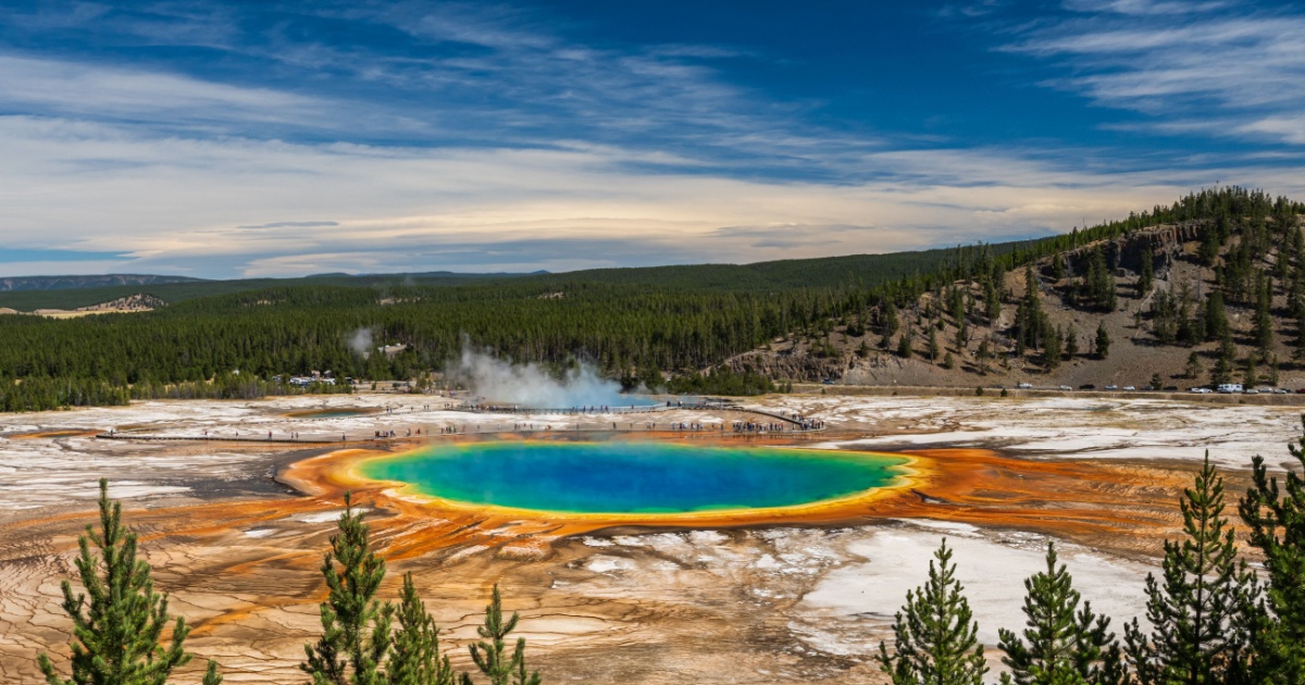

Most of what lives beneath Yellowstone National Park never makes the news. The small tremors, the slow creeping of the ground up and down by fractions of an inch, the hydrothermal systems quietly boiling away just below the surface – it all happens whether cameras are rolling or not. But lately, several threads of new science have converged at once, and the picture they’re painting is more interesting than most headlines have managed to convey.
The word “supervolcano” tends to trigger an almost Pavlovian response: doomsday footage, ash clouds racing across maps of the United States, civilization grinding to a halt. That narrative has been running on repeat since a BBC documentary planted it in the public imagination decades ago. What’s actually happening at Yellowstone is far more complex, and in some ways more surprising, than a countdown to catastrophe.
Researchers have recently redrawn the map of where Yellowstone’s magma comes from, artificial intelligence has uncovered tens of thousands of earthquakes that were hiding in plain sight, and a section of the caldera’s rim quietly lifted itself up, then stopped. Each development sounds alarming in isolation. Together, they tell a story about a volcanic system that science is only just beginning to understand.
What Yellowstone Seismic Activity Actually Looks Like Day to Day
The Yellowstone region averages between 1,500 and 2,500 earthquakes per year, and active ground deformation is a normal feature of the area. Most of these quakes are tiny, imperceptible to anyone standing above them. Most can only be studied using data from Yellowstone’s dense network of seismometers, which records extremely subtle ground motions from up to thousands of mostly tiny earthquakes every year.
During April 2026, the University of Utah Seismograph Stations, responsible for the operation and analysis of the Yellowstone Seismic Network, located 97 earthquakes in the Yellowstone National Park region. The largest event of the month was a magnitude 2.5 microearthquake about 16 miles south-southeast of Mammoth Hot Springs, and April seismicity included a swarm of 16 earthquakes in that same area during April 13 and 14. That’s not a quiet month by most standards, but for Yellowstone, it’s routine. Swarms like this are a standard feature of life at Yellowstone. They reflect the constant adjustment happening underground: fluids moving, stress building and releasing along fault lines.
Earthquakes at Yellowstone are generated by a fascinatingly complex interplay of tectonic, hydrothermal, and volcanic processes. Scientists track not just how many earthquakes occur, but where they cluster, how they migrate, and how individual swarms connect across years or even decades, because those patterns reveal what’s going on far beneath the surface.
AI Revealed 86,000 Earthquakes Nobody Knew Were There
Here’s where it gets genuinely surprising. In July 2025, a team of researchers did something that would have been impossible just a few years ago: they fed 15 years of raw seismic recordings from Yellowstone into a machine learning system, and let the algorithm find earthquakes that human analysts had missed.
A study published July 18 in Science Advances by Western University engineering professor Bing Li and his collaborators at Universidad Industrial de Santander in Colombia and the U.S. Geological Survey used machine learning to re-examine historical earthquake data from the Yellowstone caldera over a 15-year period. The team was able to retroactively detect and assign magnitudes to approximately 10 times more seismic events than previously recorded.
The reason so many events went undetected for so long has a simple explanation. Before AI, trained experts had to manually click through data looking for earthquakes, a method that couldn’t scale to catch the tiny tremors happening constantly beneath the surface. The machine learning approach didn’t find a more active Yellowstone. It found the Yellowstone that was always there, just below the detection threshold of older methods.
The study also found that more than half of the region’s earthquakes are clustered into swarm-like families, groups of small, interconnected earthquakes that spread and shift within a relatively small area over a short period of time. That’s a meaningful finding. When swarms migrate, they trace the path of fluids or stress moving through the crust. Understanding that movement is exactly what scientists need to better forecast what any given swarm actually means, and crucially, what it doesn’t mean.
The study, published in Science Advances, was clear on this point: more earthquakes in the catalog don’t translate to greater volcanic risk. These events are all very small, typically less than magnitude 1.5.
The Ground Lifted Up, Then Stopped
Earthquakes aren’t the only thing scientists watch at Yellowstone. The ground itself moves, and those movements, measured in millimeters by a network of GPS stations, can signal changes in magma or fluid pressure far below.
In July 2025, an area on the north rim of the Yellowstone caldera began to uplift slightly, the same area that had experienced uplift during 1996 and 2004. That previous episode, known as the Norris Uplift Anomaly, wasn’t trivial. Scientists wondered whether it might lead to more seismicity, larger magnitude earthquakes, or shallow accumulations of hydrothermal fluids.
According to USGS tracking of Yellowstone deformation, the uplift that started in July 2025 on the north caldera rim ceased by mid-January 2026, and deformation measurements since then indicate no significant uplift or subsidence of the caldera or north caldera rim.
There are dozens of continuous GPS stations throughout the Yellowstone region, and they show that the ground is always changing, sometimes going up and sometimes going down, typically at a rate of about an inch, or 2 to 3 centimeters, per year. Since 2015, the caldera has been going down by about an inch or so per year. That slow, rhythmic behavior of the ground reflects an active volcanic system, not one building toward an eruption.
The Magma System Just Got Redrawn
Alongside the seismic and deformation news, a major piece of foundational science landed in April 2026. A research team from the Institute of Geology and Geophysics of the Chinese Academy of Sciences built a three-dimensional model of the entire western North American mantle and came back with a finding that challenges decades of assumption about how Yellowstone is powered.
Most of Yellowstone’s magma originates from the shallow asthenosphere, the upper layer of Earth’s mantle sitting just below the rigid outer crust, with little input from the deep plume. It migrates through a tectonically controlled system and evolves in crustal reservoirs to eventually drive volcanism at the surface. The paper, published in the journal Science in April 2026, puts the magma’s origin much closer to the surface than the traditional “deep mantle plume” theory suggested.
An eastward “mantle wind,” driven by the subduction of the Farallon Plate, remnants of which lie deep beneath central and eastern North America, transports hot material toward the Yellowstone region. That sideways flow of hot rock, grinding beneath the tectonic plates, is what ultimately feeds the system, not a column of superheated material rising from deep in Earth’s core.
What does this mean practically? As molten material rises, it mixes with surrounding rock and forms a thick, sticky magma mush that behaves very differently from liquid magma. It moves slowly and resists flow, making it harder for magma to rise quickly and erupt.
That picture aligns with what the USGS has long reported about the state of Yellowstone’s magma chamber. Scientists note it is very unlikely to lead to any sort of volcanic eruption, but it will definitely teach scientists new lessons about how Yellowstone works.
For a broader look at how science is reshaping our understanding of volcanic systems worldwide, a recently confirmed supervolcano beneath Tuscany offers a striking comparison to Yellowstone’s own hidden depths.
How Close Is the Magma, Really?
One finding from recent research tends to grab attention: the magma is closer to the surface than many people assumed. Researchers at Rice University found a sharp, volatile-rich cap just 3.8 kilometers beneath Yellowstone’s surface, the top edge of the shallowest magma reservoir. That’s about 2.4 miles down, which sounds both very deep and uncomfortably close, depending on your frame of reference.
But depth alone doesn’t determine risk. The state of that magma matters far more. According to the U.S. Geological Survey, the magma chamber beneath the Yellowstone caldera is only 5 to 15 percent molten, meaning the vast majority of it is solid or near-solid rock, not the liquid pool that disaster movies tend to depict. A body of material that is mostly solid simply cannot erupt the way a liquid-filled chamber might.
The most recent volcanic eruption at Yellowstone was a lava flow that occurred 70,000 years ago. The last supereruption, the caldera-forming event that shaped the landscape visitors walk through today, occurred 640,000 years ago.
What to Do With This Information
The honest answer to “should I be worried about Yellowstone?” is: not in any practical sense. The USGS Yellowstone Volcano Observatory currently maintains a NORMAL alert level with a GREEN aviation color code, the lowest possible risk designation on both scales. The University of Utah Seismograph Stations continue to monitor seismicity, ground deformation via GPS, and hydrothermal activity across the caldera system in real time, and no current monitoring data places the system on a trajectory toward eruption.
According to the USGS FAQ on Yellowstone’s eruption timeline, Yellowstone has experienced three major eruptions at 2.08, 1.3, and 0.631 million years ago, averaging about 725,000 years between them. Based on that interval, there is still roughly 100,000 years to go, though this figure is based on just two time intervals and is, by scientists’ own admission, essentially meaningless as a prediction tool.
According to a USGS analysis of eruption probability, the annual probability of a volcanic eruption at Yellowstone is on the order of 0.001%, and even that figure is probably an overestimate for the short term.
What the recent surge of findings, including the AI earthquake catalog, the ground deformation episode, and the new magma origin model, actually represents is science getting better at watching. Sensors are more precise. Algorithms can do in hours what would take humans years. Models of the deep Earth are more accurate. The result is a richer, more textured picture of a volcanic system that has been active for millions of years and will continue to shift, breathe, and surprise researchers long into the future.
The Bottom Line
Increased detection is not the same as increased danger. That distinction matters, and it gets lost every time a headline about Yellowstone reaches for alarm instead of accuracy. What scientists have actually found over the past year is that Yellowstone is exactly as active as it always was. They just have better tools to see it now.
Yellowstone is geologically alive. It always has been. The earthquakes, the ground deformation, the hydrothermal systems: these are features of a working volcanic system, not warning signs of one about to blow. Most scientists think that the buildup preceding a catastrophic eruption would be detectable for weeks and perhaps months to years, with precursors including strong earthquake swarms and rapid ground deformation typically appearing days to weeks before an actual eruption. Right now, according to every instrument pointed at the park, none of those precursors are present. Scientists knowing more about what’s happening below the surface is precisely how we’d get early warning if anything genuinely changed. For now, there is nothing to suggest it has.
AI Disclaimer: This article was created with the assistance of AI tools and reviewed by a human editor.
Read More: This is What Happens When a Volcano Summons Lightning