
Rising sea levels are already changing local coastlines, insurance markets, and city budgets. The change is measurable, and the causes are well tested. NASA explains the mechanism with direct wording: “Sea level is rising because of added water from melting land ice and the expansion of seawater as it warms.” Higher baseline seas lift everyday high tides and raise storm surge starting points. They also push saltwater farther into drains and aquifers. By 2050, these pressures will intensify because oceans store heat for decades and ice loss continues.
The next 25 years will test how well societies prepare for a higher waterline. Some places will cut risk with upgraded drainage, stronger building codes, and restored wetlands. Others will face repeated flooding, property losses, and forced moves. This article explains what drives rising seas, what 2050 projections suggest, and which choices can limit damage for people and nature. That work starts with honest measurements and practical planning timelines.
The basic mechanics that push oceans upward
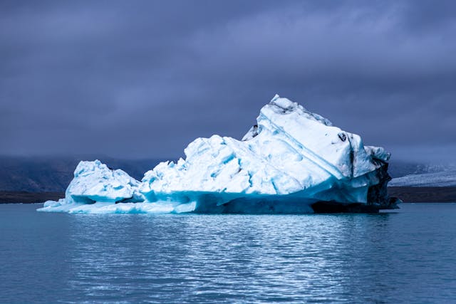
Sea level rise begins with heat moving into the ocean system. When seawater warms, it expands, so the same basin holds more volume. At the same time, land ice loses mass and adds water to the sea. Glaciers respond quickly, while ice sheets can respond in bursts or lags. Regional winds and currents also shift water, creating higher local sea levels in some places. None of these processes requires guesswork, because they are measured with satellites and tide gauges. Even small average changes matter because coasts are flat and tightly developed. Once the baseline rises, a high tide can cross thresholds that once stayed dry. NASA summarizes the two dominant drivers in one sentence: “Sea level is rising because of added water from melting land ice and the expansion of seawater as it warms.”
That framing matters for choices, because heat and ice respond to emissions. Lower emissions slow ocean heating over time and reduce long run ice loss risk. Yet the near-term rise continues, because the ocean stores heat and releases it slowly. In recent years, NASA notes that land ice melt and thermal expansion both contribute to the rise. Year-to-year swings can occur, but the overall direction remains upward. That is why adaptation cannot wait for perfect scenarios. Communities need designs that match infrastructure lifetimes and funding cycles. Practical steps include raising electrical equipment, protecting pump stations, and keeping evacuation routes open. Good plans also treat sea level rise as a chronic stress, not only a disaster trigger. Decision makers cut losses most when they plan before redevelopment, because rebuilding windows is often short and expensive.
2050 projections mean in practical terms
Sea level projections include a range because future emissions and ice responses differ. However, mid-century estimates are tighter than end-century estimates. They are also more relevant to mortgages, bridges, ports, and water networks built today. In the United States, a multi-agency assessment summarized by NOAA sets a clear expectation. It reported that “sea levels along the coastline will rise an additional 10-12 inches by 2050.” That figure describes an average, not a cap, and regional values vary with land motion and currents. Some Atlantic and Gulf locations face a higher relative rise because subsidence adds to the waterline. A rise of nearly 0.3 meters can transform the frequency of flooding. Flood thresholds are crossed more often because tides start from a higher base. Storm surge also starts higher, which increases flood depth for the same storm.
Drainage becomes harder because higher seas raise coastal groundwater and reduce outflow. That can create flooding from below, as water backs up through pipes and low ground. Planning for 2050, therefore, needs local maps, not a single global number. It also needs time steps, because projects are staged and budgets are annual. Many agencies now use staged scenarios through 2050 to guide design. These milestones align with resurfacing cycles, pump replacement cycles, and zoning updates. When planners test roads, hospitals, and power stations against the higher baseline, weak points appear fast. Those weak points guide which upgrades deliver the biggest safety gains first. Early action also reduces disruption, because upgrades can happen during routine maintenance. Delaying forces emergency repairs, which usually cost more and provide less for residents and public services.
Flooding is increasing even without extreme storms
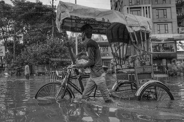
Coastal flooding is increasing because higher seas change the baseline for every tide. Places that once flooded only during major storms now flood during ordinary high tides. Water can also enter from below when groundwater rises, and storm drains lose capacity. This is why some residents see flooding on clear days, with no rainfall nearby. Road closures, corroded pipes, and blocked access routes can follow even modest water levels. The risk grows fastest in low, flat areas where a few centimeters spread far inland. Businesses lose operating hours when customers cannot reach entrances or parking. Homeowners face repeated cleanups that slowly damage wiring and foundations. Local context matters because sea level rise is not uniform from place to place. The Congressional Research Service makes that point in a line planners should memorize:
“The rates of relative sea-level rise at specific locations are likely more important to coastal communities and coastal ecosystems than the global sea-level average trends.” That is because land can rise or sink, and currents can shift regional water height. Two nearby towns can face different flood frequencies even with the same global trend. Storm surge then adds to the local baseline, producing higher peak water levels. Heavy rain can compound the problem when rivers cannot drain to a high sea level. Emergency services can be delayed when roads flood at high tide. Schools and clinics can also lose access, even when buildings stay dry. Tracking local tide gauges and setting clear flood thresholds helps communities act earlier. Clear public alerts also reduce panic, because residents know when water will arrive and when water will recede.
When the ground sinks, sea level rise accelerates locally
Global sea level rise is only part of the water story for many coastlines. The other part is vertical land motion, especially subsidence in sinking regions. When land sinks, the relative sea level rises faster at that location. The result is a higher flood risk even if the ocean rises at the expected global pace. Subsidence can be driven by geology, but human activity often accelerates it. Groundwater withdrawal, oil and gas extraction, and draining organic soils can all contribute. In some cities, the sheer weight of buildings on soft sediments adds extra settling. USGS is blunt about the dominant driver in many places. In its subsidence fact sheet, it states: “The compaction of unconsolidated aquifer systems that can accompany excessive ground-water pumping is by far the single largest cause of subsidence.” Compaction can be permanent, which means the land does not rebound when pumping slows. Subsidence also damages infrastructure before any ocean water arrives.
Roads crack and pipes shear, while foundations shift as the ground drops unevenly. Drainage grades weaken, so stormwater pools longer after rain. In coastal zones, lower land elevation also increases saltwater intrusion pressure. Monitoring with satellites and benchmarks can map hotspots with high precision. Water agencies can then set pumping limits, recharge aquifers, or shift demand to surface water. Building codes can also require flexible joints and deeper foundations in known subsidence zones. These actions reduce risk because they slow the land drop that amplifies rising seas. Subsidence management also improves projection accuracy, because planners can separate land motion from ocean change. That separation helps target investments that prevent future flooding over time for communities.
The economic stakes for ports, housing, and city budgets
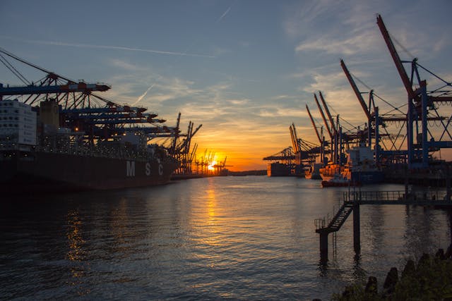
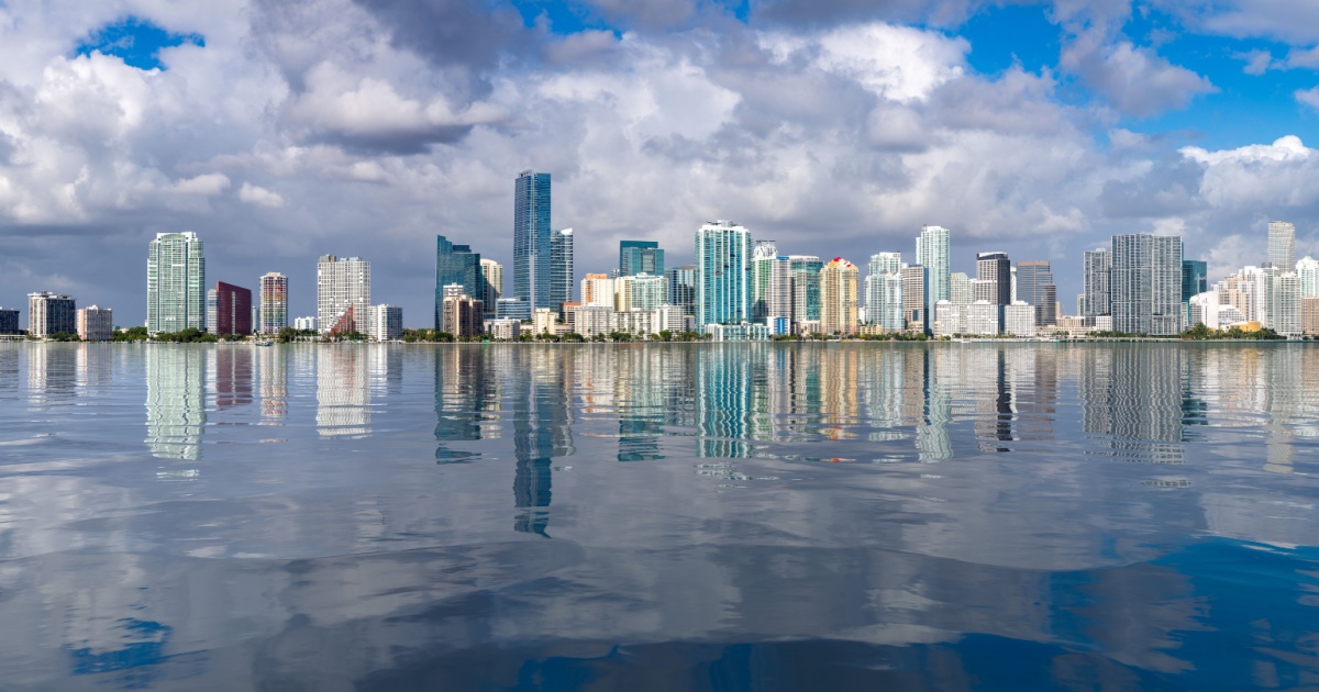
Rising seas cause economic losses through damaged assets, disrupted work, and higher operating costs. Ports sit near sea level because ships need deepwater access. Airports, rail lines, and highways often follow the same low corridors. When these systems flood more often, supply chains slow, and repair bills climb. Even when a city avoids catastrophe, repeated minor floods can degrade wiring and pumps quickly. Saltwater corrosion shortens the life of bridges and electrical gear. Tourism economies can also suffer when beaches erode, and waterfront access closes. The World Bank has highlighted how fast exposure is compounding in coastal cities. In a feature summarizing work led by World Bank economist Stephane Hallegatte with the OECD, it warns that “global flood damage for large coastal cities could cost $1 trillion a year if cities don’t take steps to adapt.”
That figure captures both higher water levels and higher value at risk, because coastal development continues. Insurance markets respond by raising premiums, narrowing coverage, or exiting high-risk zones. Households then face harder choices about rebuilding, retrofitting, or moving. Public budgets also strain because repairs compete with schools, policing, and health services. Cost-effective adaptation often starts with protecting critical nodes, such as substations and hospitals. Cities can also require higher finished floor elevations for new buildings. Financing tools include resilience bonds, dedicated stormwater fees, and targeted national grants. Transparent cost-benefit work helps win support because residents see what projects are prevented. Each avoided rebuild saves money twice, because it prevents damage and reduces downtime. Over time, consistent upgrades can stabilize insurance access and protect municipal credit ratings in coastal neighborhoods and zones.
Displacement risks
Rising sea levels do not hit everyone equally, even inside the same city. Lower-income households often live in higher-risk zones where land is cheaper. They also have fewer resources for elevating homes or paying for repeated repairs. In many countries, informal settlements sit on floodplains and reclaimed land near ports. When high tides become frequent floods, work becomes unreliable, and health risks increase. Saltwater can contaminate shallow wells and damage sanitation systems. These pressures can push people to move, first locally, then farther inland. Families often move more than once as rents rise and savings shrink. The World Bank has modeled this migration pressure in its Groundswell work. In an overview of its findings, it states that “by 2050, as many as 216 million people could be internal climate migrants across the six World Bank regions.”
Sea level rise is one driver within that total, alongside water stress and crop impacts. However, coastal risk matters because so many people and jobs cluster near the sea. Migration can be planned or chaotic, and the difference shows in human suffering. Planned movement needs affordable housing, jobs, and services in safer areas. It also needs transport that connects new neighborhoods to work. Cities can identify future risk corridors and guide growth away from them now. Governments can reduce forced displacement by protecting key infrastructure, like water treatment plants. They can also support voluntary moves with buyouts and fair compensation. Without these supports, rising seas can widen inequality and increase instability for decades. Strong social safety nets also help, because they keep people housed during transitions and often reduce conflict in receiving communities.
Wetlands, marshes, and coastal protection from nature
Coastal ecosystems can reduce flood risk while supporting fisheries and tourism. Salt marshes, mangroves, and tidal flats absorb wave energy and slow the surge. They also trap sediment, which can help them build elevation over time. Many wetlands store large amounts of carbon in their soils for long periods. When wetlands erode, that stored carbon can be released, and water can become more turbid. However, these systems need space to shift inland as the sea level rises. When that path is blocked by hard defenses and dense development, habitat can shrink. The loss is sometimes gradual, but it can accelerate after storms. Once a marsh edge collapses, waves can carve deeper channels that widen the damage. Researchers at the University of Cambridge describe the core trap in simple terms.
They wrote, “While dikes provide flood defence to coastal populations and infrastructure, they prevent wetlands from moving landwards and upwards: dikes leave them with nowhere to go.” This is the coastal squeeze problem, and it carries real costs for people. Without wetlands, the surge reaches farther inland with more force. Water quality can also decline because wetlands filter sediment and pollutants. Communities can respond by restoring marsh platforms, removing barriers, and protecting migration corridors. Living shorelines can reduce erosion while keeping habitat intact. Zoning can also set back new construction, leaving room for marsh migration. These projects still require land access and long-term maintenance. Yet they can deliver protection that grows with time, which hard structures often cannot. Keeping natural buffers healthy also supports local jobs tied to fishing and recreation. It also reduces seawall maintenance bills when waves strike higher and harder.
Read More: Scientists Propose Releasing 12 Million Tons of Particles Into Atmosphere to Combat Climate Change
Choices that change the curve, and choices that lock in losses

By 2050, the sea level will be higher than it is today, so planners must accept it. The bigger question is how fast the rise continues after mid-century. That depends on emissions, ice sheet behavior, and how much heat the ocean absorbs. Choices made now shape those drivers, but they also shape exposure and vulnerability. Building in high-risk zones adds future losses even if the sea rises less. Building smarter can reduce losses even if the sea rises more. Public agencies can also avoid locking in risk by updating flood maps and infrastructure standards. The IPCC’s AR6 Summary for Policymakers is direct about the long-term direction. It states: “It is virtually certain that global mean sea level will continue to rise over the 21st century.” That certainty should change how governments price risk and approve development.
Mitigation slows the long-run rise by limiting warming, but it cannot erase the near-term change. Adaptation reduces damage from the rise already underway. Practical steps include elevating critical facilities, upgrading stormwater systems, and protecting drinking water from salt intrusion. Building codes can require flood-resilient materials at ground level and safer electrical placement. Nature-based projects can also help when they are designed to survive higher water levels. Some locations will need managed retreat where erosion undermines roads and sewers. Retreat works best when it is planned early, with clear rules and fair compensation. Communities can use monitoring and scenario testing to trigger upgrades when thresholds are reached. Taken together, these choices can keep 2050 livable, even along vulnerable coasts. The cost of delay is paid in emergency spending, disruption, and avoidable trauma.
Conclusion
Rising sea levels are a near-term reality with long-term consequences. The mechanisms are understood, and measurements already appear in tide gauges and satellites. By 2050, higher baseline seas will push high tides into streets more often. They will also raise storm surge impacts and worsen coastal groundwater problems. In many regions, subsidence will amplify the hazard and speed local waterline change. That combination can damage homes and infrastructure even without a headline disaster. It can also strain insurance markets, municipal budgets, workforces, and trust.
A safer 2050 depends on choices made well before the water arrives at the doorstep. Cutting emissions can slow the future rise and reduce long-run ice loss risk. Local planning can reduce losses through smarter drainage, stronger codes, and restored buffers. It can also guide growth away from the most exposed land, before more value accumulates there. Where retreat becomes unavoidable, early planning can protect dignity and prevent chaotic displacement. The ocean will keep rising for a long time. Communities still control how prepared they are, and how fairly they share the burden, with clear timelines and funding
A.I. Disclaimer: This article was created with AI assistance and edited by a human for accuracy and clarity.
Read More: NASA’s Recording of Eerie ‘Woman’s Voice’ in Deep Ocean Remains Unsolved After 25 Years