This article was originally published October 13, 2019 and has since been updated.
Written By: Jordan Nisbet
According to a recent study published in the journal Gondwana Research, a lost continent has been found buried under southern Europe, and sadly, it’s not Atlantis [1]. Bummer.
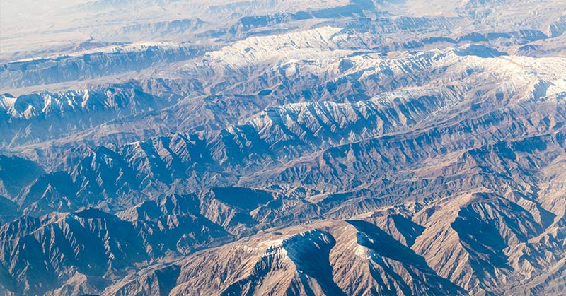
A great deal of the continental crust has been submerged under the earth, but a lot of it is still visible today. From Turin to Puglia in Italy, a strip of land the size of Greenland is what remains of Greater Adria, so named because it was discovered to have settled in the Adriatic region.
The territory was said to have broken away from North Africa 200 million years ago, and during its thriving time, it was mostly underwater, covered by coral reefs, sediments, and shallow seas.
“Forget Atlantis,” said Douwe van Hinsbergen, lead researcher and author of the paper [2]. “Without realizing it, vast numbers of tourists spend their holiday each year on the lost continent of Greater Adria. Most mountain chains that we investigated originated from a single continent that separated from North Africa more than 200 million years ago. The only remaining part of this continent is a strip that runs from Turin via the Adriatic Sea to the heel of the boot that forms Italy.”
Reconstruction of the tectonic plates
Tectonic plates are pieces of the earth’s upper crust, also known as the lithosphere. The tectonic plate system is a theory that propagates the division of the earth’s outer layer into several plates that glide over the rocky core.
Plate tectonics help geologists describe the formation of continents and oceans, a phenomenon made possible because these plates do not undergo deformation when they glide past one another. This is why there are still distinct continents that have not been completely submerged under each other over the years.
In the Mediterranean Region, the theory doesn’t exactly apply. “It is quite simply a geological mess: Everything is curved, broken and stacked,” said van Hinsbergen. “Compared to this, the Himalayas, for example, represent a rather simple system. There you can follow several large fault lines across a distance of more than 2,000 kilometers.”
When the plates in the region glide past one another, parts of some areas are scraped off and piled on top of one another as rocky mountains.
“Subduction, the plunging of one plate under the other, is the basic way in which mountain chains are formed,” said Van Hinsbergen. “Our research provided a large number of insights, also about volcanism and earthquakes that we are already applying elsewhere. You can even predict, to a certain extent, what a given area will look like in the far future.”
Tearing down layers to reveal a lost part of the world
The researchers designed a software application that allowed the reconstruction of the tectonic plates. They went back several layers until the mapping of the world began to take a different light from what is known today. Greater Adria then came into full view of what it had been before its evolution began in the Triassic period.
“From this mapping emerged the picture of Greater Adria, and several smaller continental blocks too, which now form parts of Romania, North Turkey or Armenia, for example,” said Van Hinsbergen. “The deformed remnants of the top few kilometers of the lost continent can still be seen in the mountain ranges. The rest of the piece of continental plate, which was about 100 km thick, plunged under Southern Europe into the earth’s mantle, where we can still trace it with seismic waves up to a depth of 1,500 kilometers.”
This process was not exactly straightforward because each country has a different understanding of global geological history. They could only alter so much to accommodate the massive discovery.
“This is not only a large region, but it also hosts more than 30 countries. Each of these has its own geological survey, own maps, and own ideas about the evolutionary history. Research often stops at the national borders. Therefore, the region is not just fragmented from a geological perspective.”
Other lost continents have been discovered as well
In September 2017, a team of researchers at the University of Otago in New Zealand discovered the lost continent of Zealandia [3]. It was a landmass submerged in the southwestern region of the Pacific Ocean, buried about a kilometer beneath the sea. Zealandia was said to have begun taking shape about 85 million years ago, which makes it “the world’s youngest known continent.”
In January 2017, a team of researchers from South Africa’s University of Witwatersrand discovered Mauritia, an ancient continent buried under the Island of Mauritius [4]. It was believed to have broken up from Gondwanaland, a super-continent that existed about 200 million years ago. The lava-covered landmass has now been classified as a part of Mauritius.
At this rate, there may be hope for us Atlantis lovers. Could our lost cit be discovered soon?
Sources
- Hinsbergen et al. Orogenic architecture of the Mediterranean region and kinematic reconstruction of its tectonic evolution since the Triassic. Science Direct. https://www.sciencedirect.com/science/article/pii/S1342937X19302230. Retrieved 10-10-19
- Ashley Strickland. A lost continent has been found under Europe. CNN. https://edition.cnn.com/2019/09/23/world/lost-continent-europe-scn-trnd/index.html. Retrieved 10-10-19
- Contributor. How the submerged continent of Zealandia took shape. Nature. https://www.nature.com/articles/d41586-018-07884-y. Retrieved 10-10-19
- Juliet Perry. ‘Lost continent’ found under Mauritius in the Indian Ocean. CNN. https://edition.cnn.com/travel/article/lost-continent-mauritius-trnd/index.html. Retrieved 10-10-19
- Plate tectonics. Britannica. https://www.britannica.com/science/plate-tectonics. Retrieved 10-10-19